the end

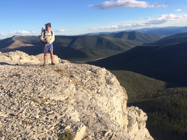
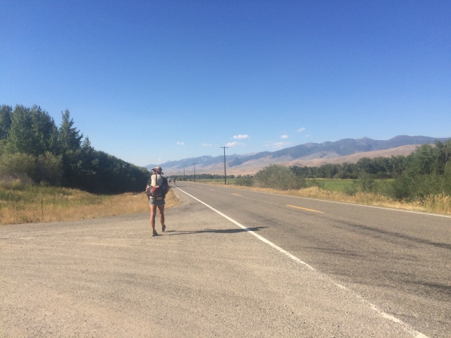
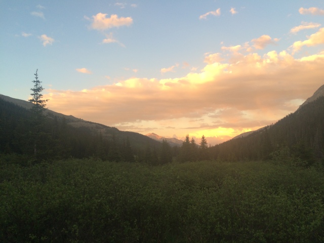
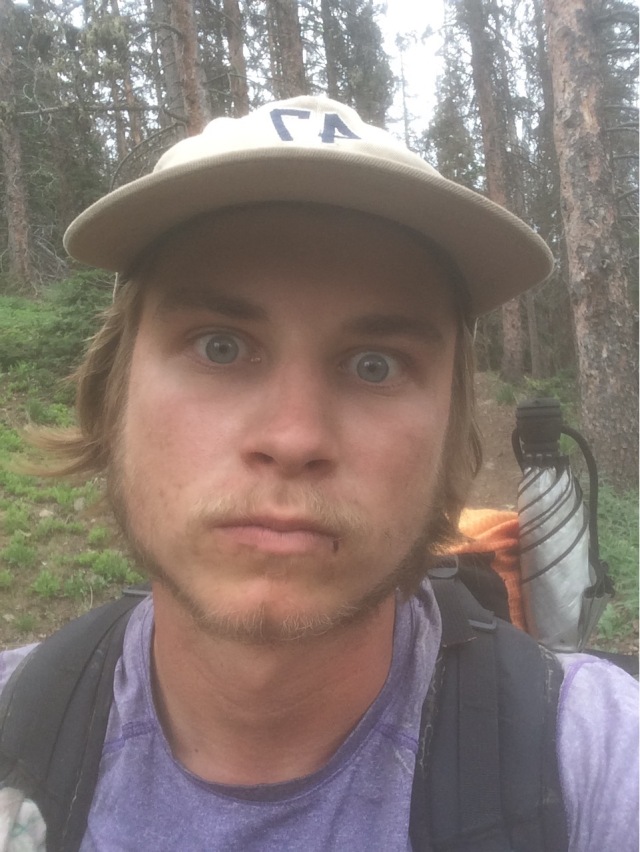
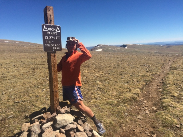
My name is Slingshot. I’ve nearly walked the continental divide from Mexico to Canada. I’ve seen many things. I’ve seen it rain as the sun comes out. I’ve come face to face with a silvertrip grizzly bear. I’ve walked underneath the Milky Way through the desert. I’ve seen the full moon rise and set. I cried up high in the Wind River range, looking at the heavens. I have walked alone. I have walked with friends I love. I drank from the headwaters of the Yellowstone. The Fountain of Youth. That water is with me, in me. I do not know what tomorrow will bring. Joy? Maybe hopeful suffering in the face of an early winter storm. I still have miles to go. There are no answers, but that’s okay.

I wrote that in my journal before leaving Helena and embarking on the last 360 miles towards Canada. A little corny, but I’ve always been a sucker for corniness and trying to see romantic epicness in the world around me.

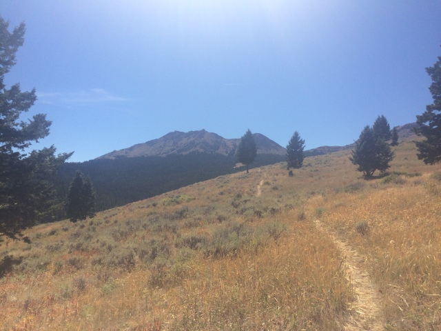
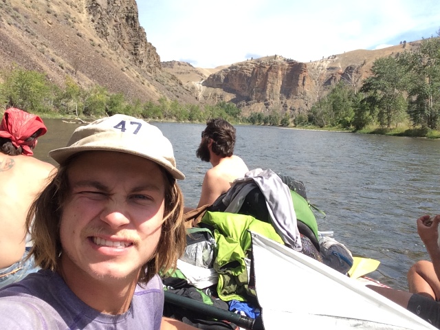
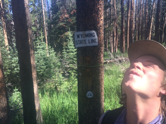
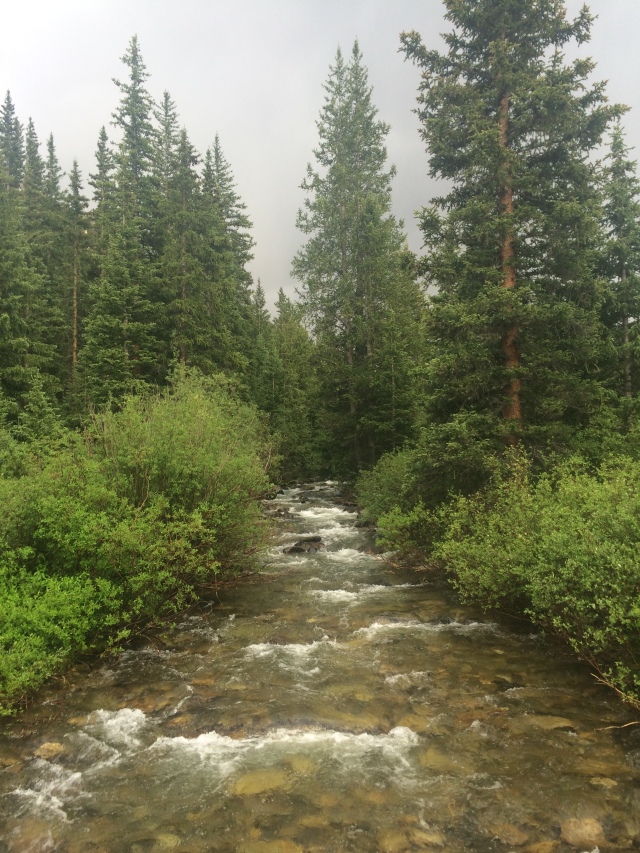
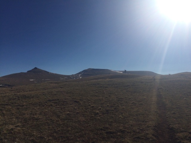
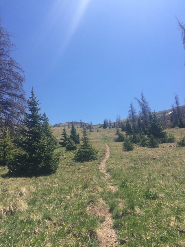
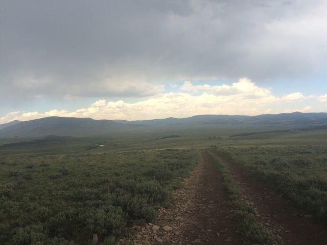
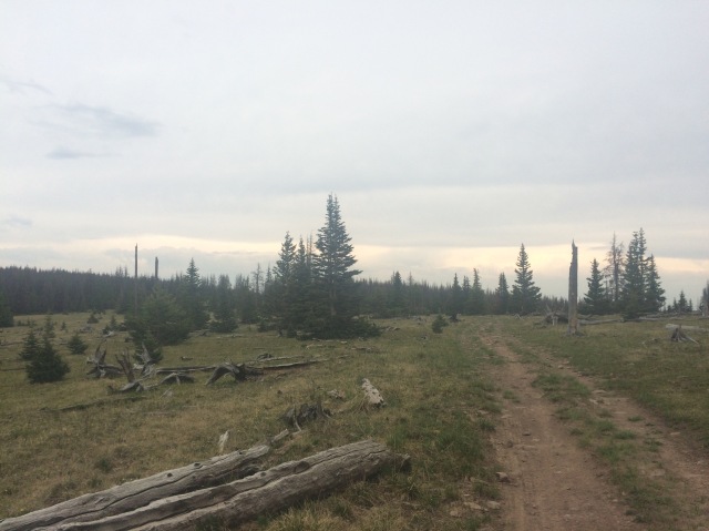
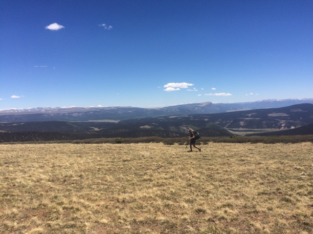
In the morning, Cowboy Stripper’s friend gave us — Cowboy, Handstand, Boston Chris, and me — a ride back up to MacDonald Pass. The weather report predicted cold weather and a potential snowstorm over the next few days. It was only 65ish miles to Lincoln, our next stop, so I didn’t worry about the weather too much… Upon getting out of the car, it was already chilly, and I was walking in my fleece and rain jacket for warmth along with my ripped up gloves. We walked through trees on top of the divide with the occasional open meadow. The clouds slowly surrounded us. I could only see about 100 feet in front of me at some points. The trail took us down into cow country and onto 4WD roads. We took a break under some trees as it began to rain. I made some coffee with my stove. I just got it back in Helena and also indulged in buying some grounds from the local roastery. Ethiopian beans, medium-light roast. Mmmmm.

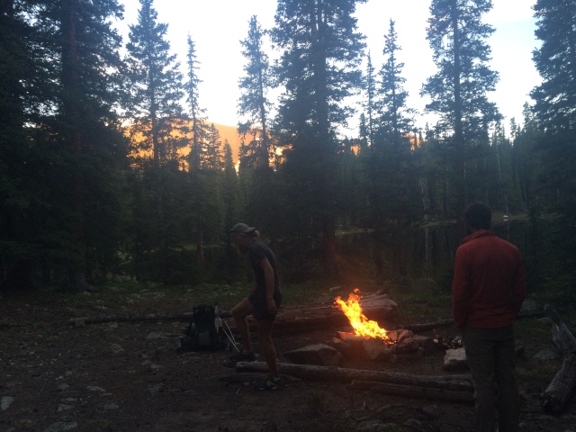
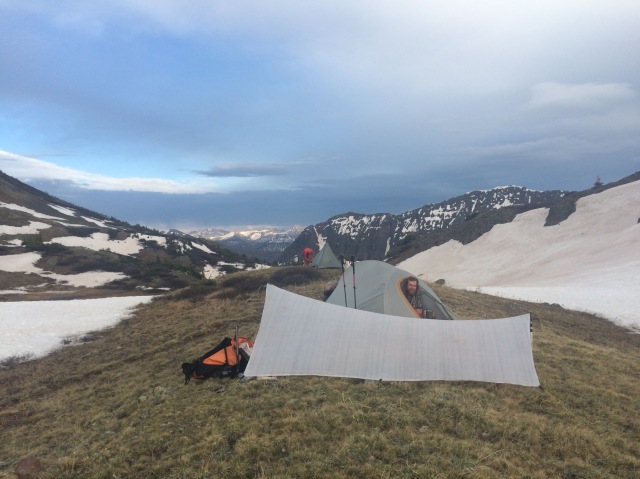
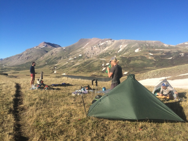
We walked through the light rain that afternoon as the temperature dropped.  We eventually found a super sheltered spot under some pine trees to crash in. There was cow shit everywhere, but I’m pretty used to that at this point and don’t really care about it. That’s what my groundsheet is for. It felt good to eat a hot meal on trail for the first time since before Steamboat Springs, CO.

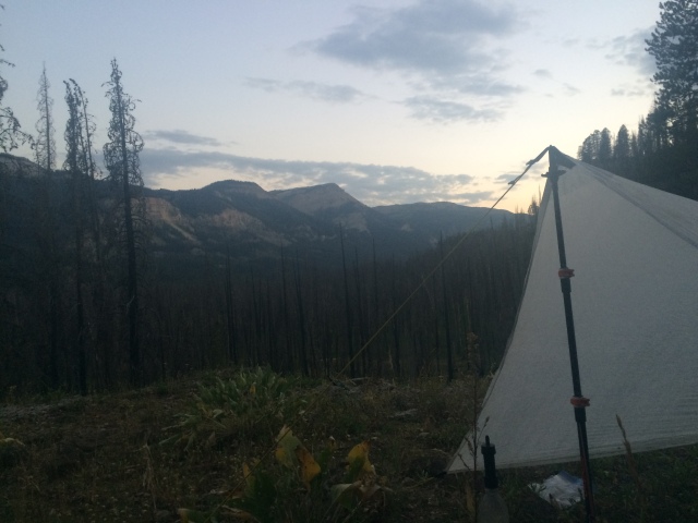
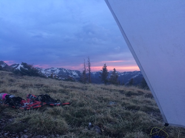
I woke up and looked up. My tarp was slightly bowed in the middle under the weight of some snow. I knocked it off from within and grimaced as I looked outside. Our little sheltered area was pretty much free of snow, but beyond that it was a winter wonderland. I rolled over and made some coffee, still in my sleeping bag. I hummed, “well the weather outside is frightful…” and looked around at the others. Cowboy was still sleeping (classic) and Handstand was stirring around.

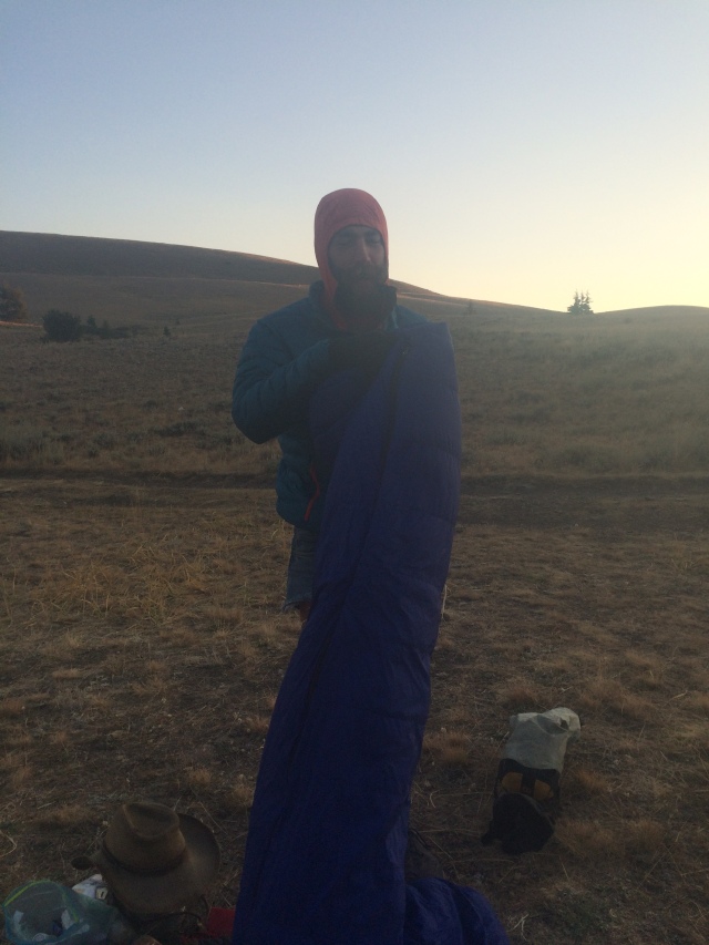
After some wishful thinking, I finally bit the bullet and took off my long underwear to put on my wet shorts. Now I had to move. I packed up as much as I could while still under my tarp then got out. I rolled up the icy cuben fiber with my bare hands and moaned because I thought they were gonna fall off. I shoved them between my thighs and groaned some more. It’s gonna be a long day, I thought.

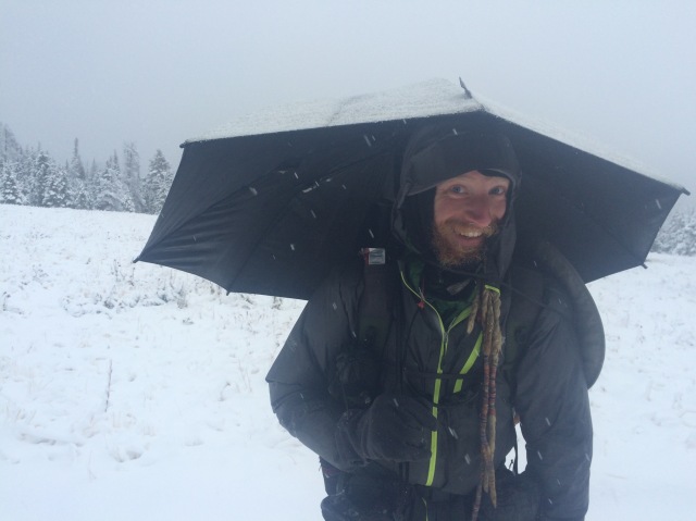
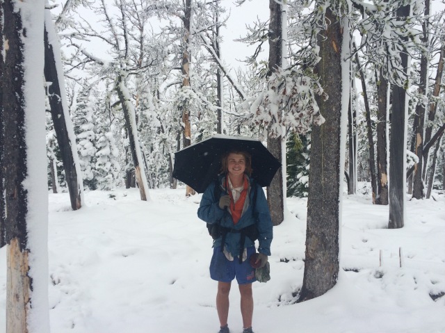
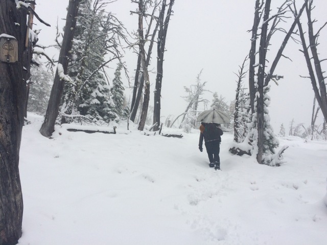
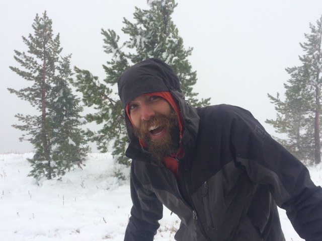
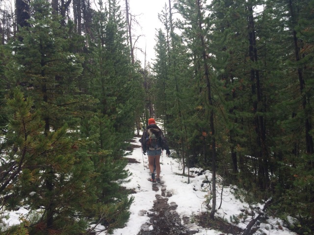
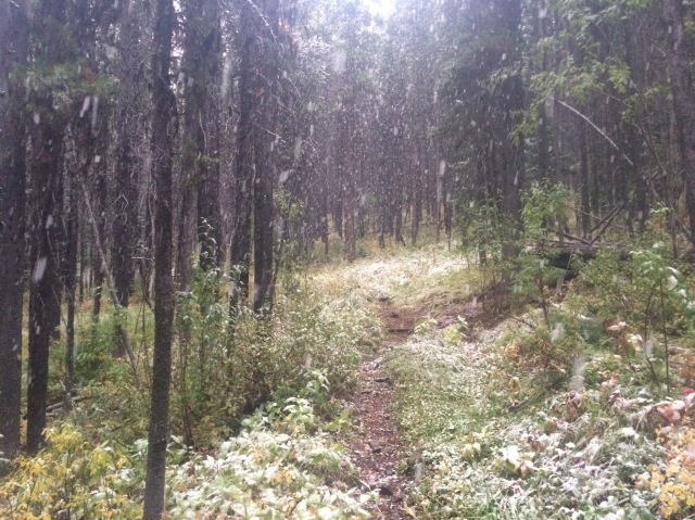
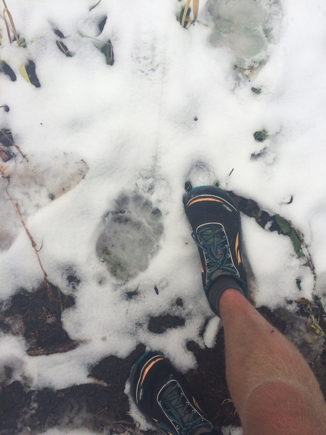
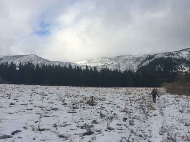
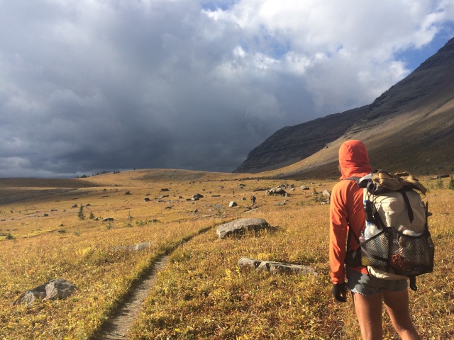
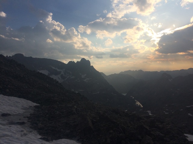
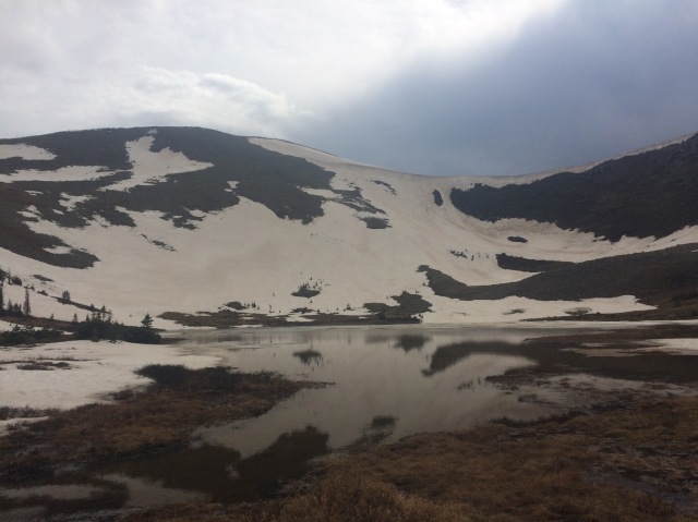
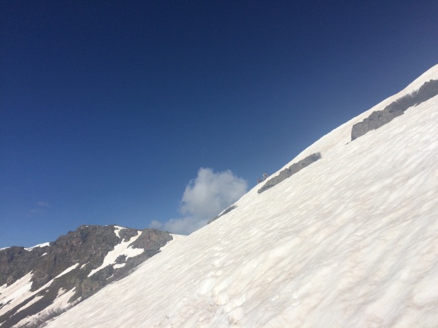
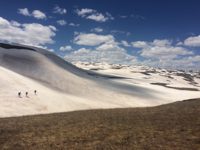
I set off into the blizzard by myself. It was pretty much whited out and still coming down heavily. We had at least 4 inches at that point. Handstand quickly caught up to me, and we walked the morning together. The trail was on a dirt road, so it was still relatively easy to follow. I kept my phone inside my fleece, resting on top of my belly and hip belt to keep it warm. My battery drains and dies in the cold. We gained elevation as the snow depth increased and walking grew more difficult. At our highest point, I estimated the snow to be just under 10 inches. Despite my cold feet and no knowledge of when this storm was going to end, I had a blast all day. Maybe it was the brightness of the pure white snow, but I smiled for hours straight. We were doing this, walking through snow in shorts and sneakers. It was absurd. And I love the absurd. Cowboy caught up to us at lunch. Luckily the wind wasn’t too bad.

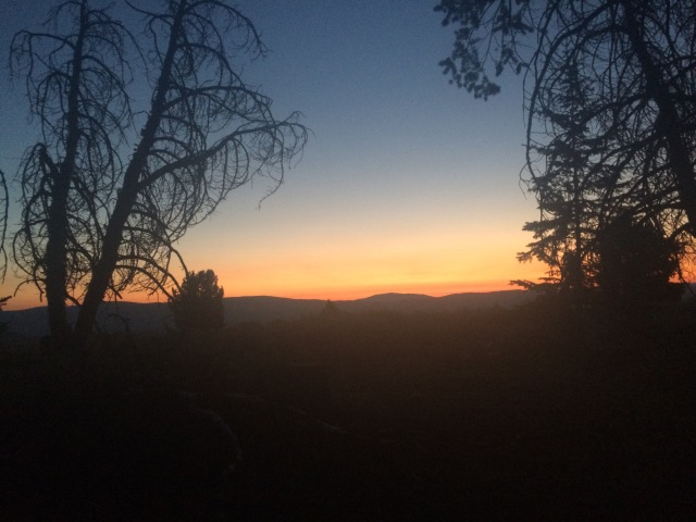
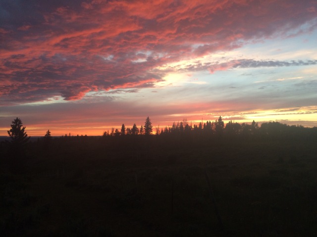
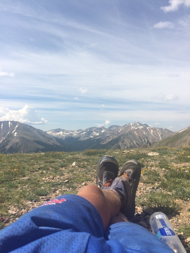
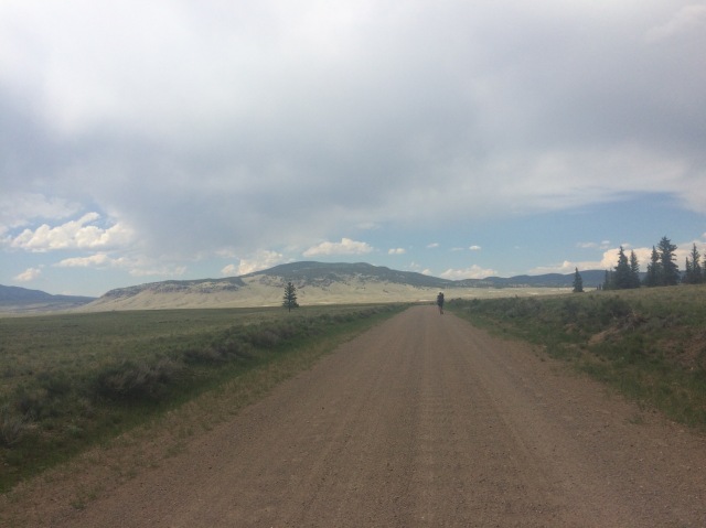
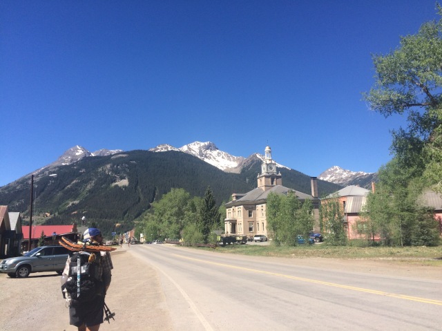
It cleared up a bit in the afternoon, and the snow started to melt. We found a pretty good campsite that night with a fire ring but were unable to start a fire because it was so wet. We didn’t try that hard though. The next morning I woke up to a gorgeous sunrise and painful achilles. I guess I put a lot more stress on my calves and tendons while walking through the snow. I hobbled uphill and shuffled downhill. I was in some serious pain and was a bit worried. The pain eventually got better, or I got more used to it, and we walked about 23 miles to Rogers Pass, where we would hitch into Lincoln. It took a while to get a hitch, but a sheriff eventually drove us into town where we split a motel room between the three of us and Boston Chris. A bunch of other hikers were in town recovering from the snow like us.

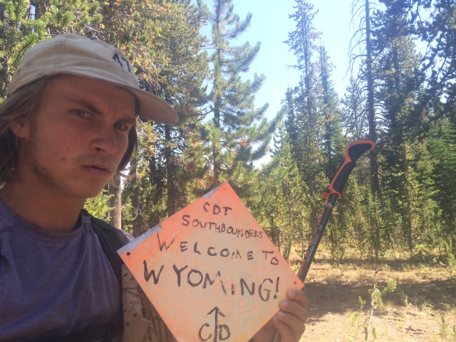
Winter was coming early. People were posting on the CDT facebook page about a series of winter weather events moving in throughout September. I guess we deserved it. The weather along this entire trail has been amazing. The thunderstorms weren’t too bad in Colorado and it hardly rained at all through Wyoming.

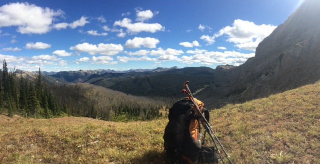
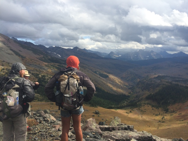
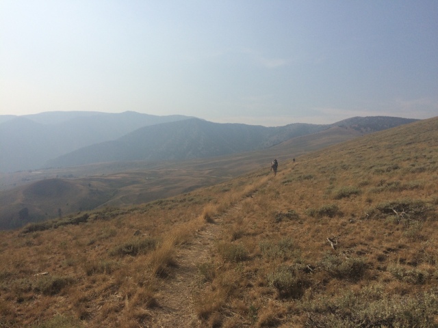
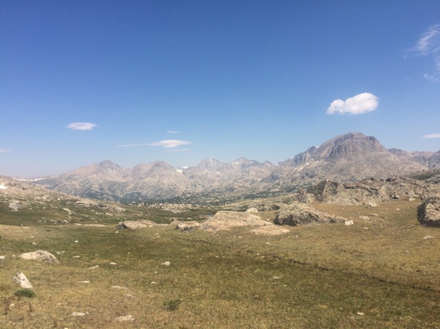
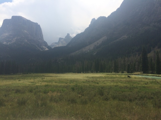
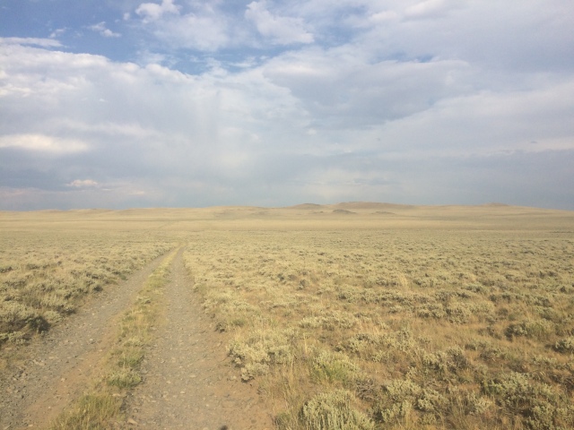
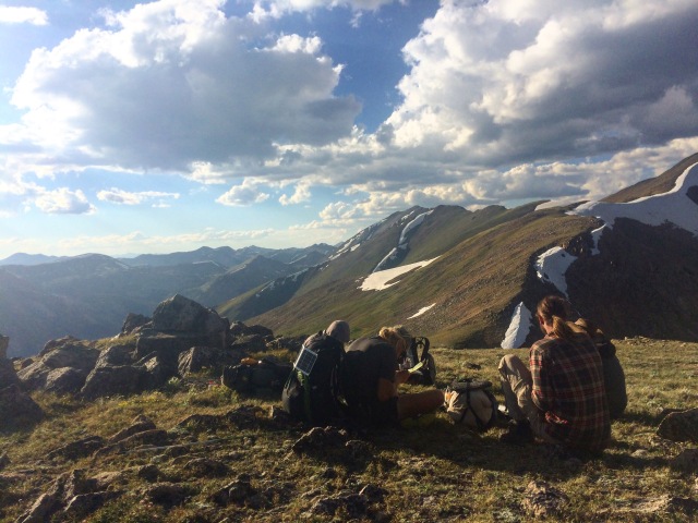
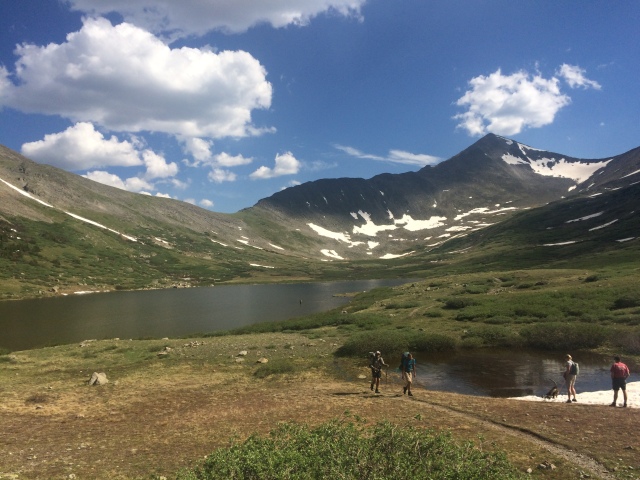
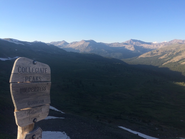
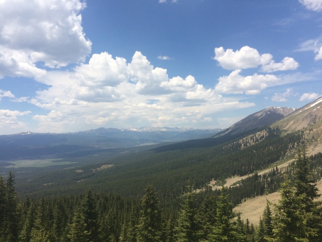
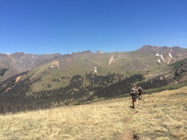
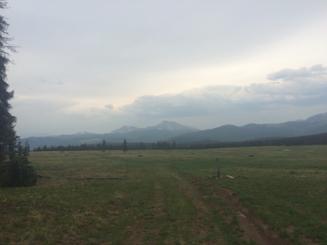
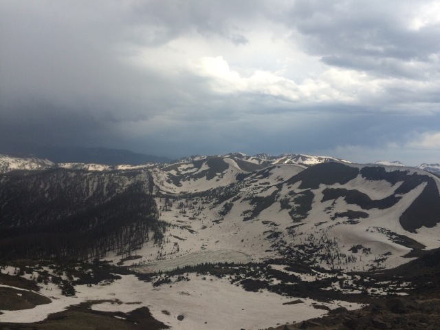
Our next leg was 180 miles through the Scapegoat Wilderness and Bob Marshall Wilderness to East Glacier, just outside Glacier National Park. Cowboy and I prepared to do it in 6.5 days since we weren’t picking up a package at Benchmark Ranch. The weather looked okay… okay as in very windy for the next few days and potential snow  on the 5th and 6th days.

We left Lincoln in the afternoon and climbed up out of Rogers Pass. Up on the divide, we had to climb up and down hills and peaks as it got windier and windier. We saw a great rainbow and ran into a hiker we hadn’t seen since Colorado. The next morning I got a pretty early start and immediately ran into some wind and light rain up on the divide. I had my tattered frogg toggs rain jacket fully cinched and pulled my frigid hands into my sleeves. I dropped down briefly where a trail took me past a water source. I passed Elusive and also Fix-It and her husband. Elusive is 73, Fix-It is 71 or something, and her husband is 76… WOW! I hope I’m still walking when I’m that old.

I climbed back up to the divide and found myself facing a sideways hailstorm. Whenever I looked up, 50mph wind would slap and sting my face with ice. I was pretty much hike-jogging for over an hour until the storm subsided a bit. Cowboy caught up to me before lunch.

We looked at each other and laughed. “That was absurd,” he muttered through his bushy beard and mustache.

“And you’re wearing jorts,” I replied.

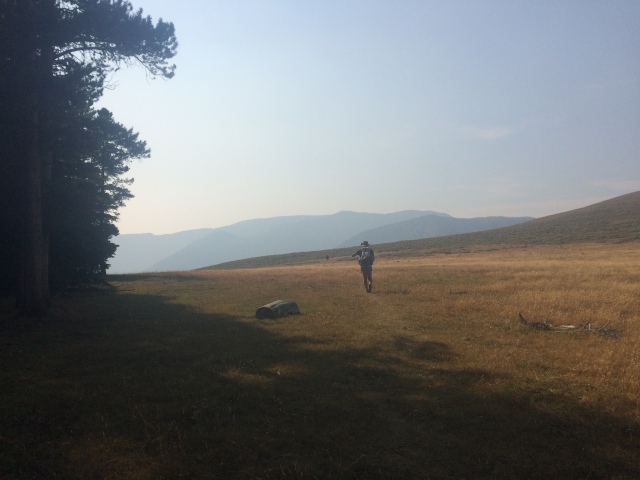
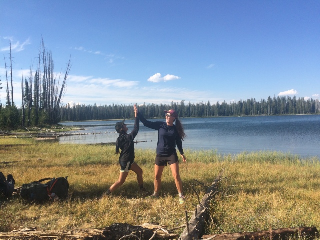
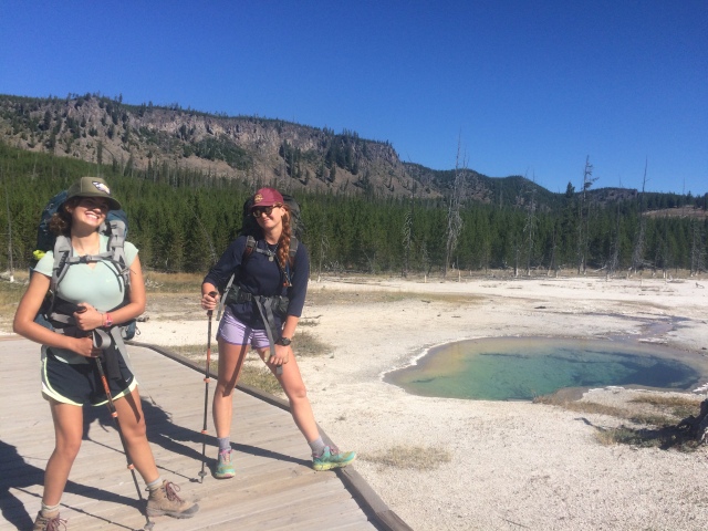
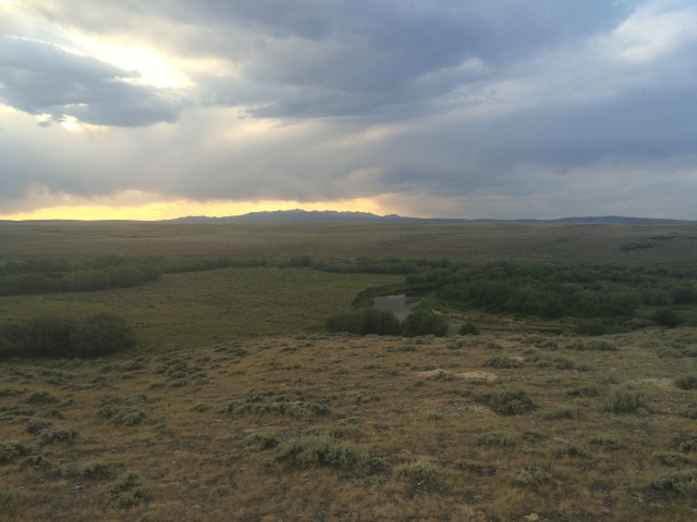
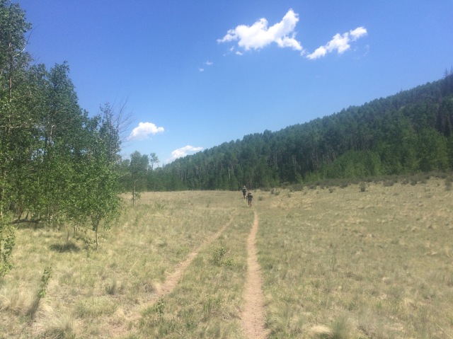
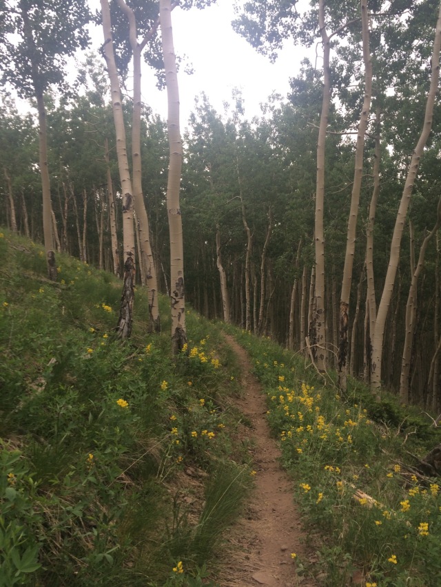
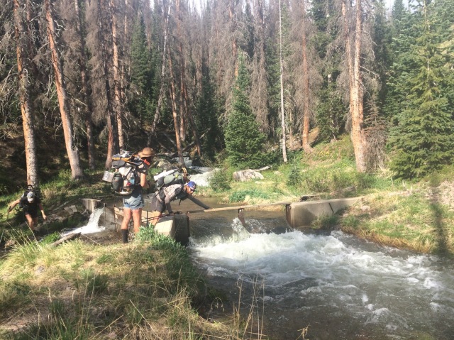
We dropped down a long ways into a river valley as the sun came out. Oh it felt so good. We dried out our gear and kept walking after that. We met a section hiker and walked with him throughout the late afternoon and early evening. We heard some hooting and hollering as we were looking for a place to camp. I thought it was Rampaige, Handstand, Lucky, and Boston Chris, so I started screaming back. “PENIS!” I screamed. “I LIKE PIZZA!” was the response. I crossed the creek, filled up water, and walked over to the patrol cabin where they were. A dog ran up and started barking at me. A man came up and talked to me. A bible college class from Augusta was taking a backpacking trip. There were a bunch of 18 and 19 year olds. They came over as I set up my shelter and asked a bunch of questions about my trip. They asked good questions (not the usual “so, you sleep on the ground every night?”) and shot the bull for a while. One of them had taken a big, 50 day road trip through all the states, so I asked him about that for a while. Cool stuff. They got me thinking more retrospectively and started my internal thought/day dream process for the rest of the trail. What was the significance of what I was doing? Why am I out here? What have I learned? Have I changed? What will I do when I finish? Stuff like that. Questions that spark answers that lead to new questions and then I eventually give up and slip into a fantasy about being a rockstar.

That night I slept pretty well despite snuggling with a field mouse. It ran up and down my arm a few times, but I didn’t really care. I got started in the morning before Cowboy. “See ya down the way,” I said. “Yup yup,” he replied as he ate oatmeal in his tarp. Well it turned out we wouldn’t see each other again until East Glacier (oops) because we took different routes that day. He ended up way ahead of me.

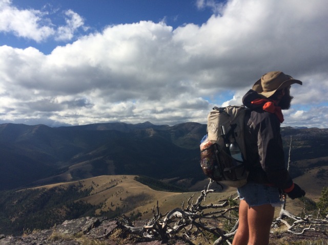
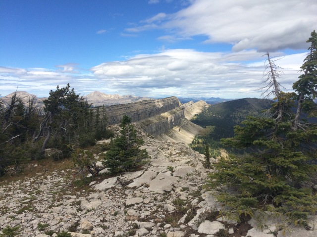
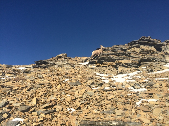
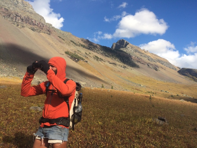
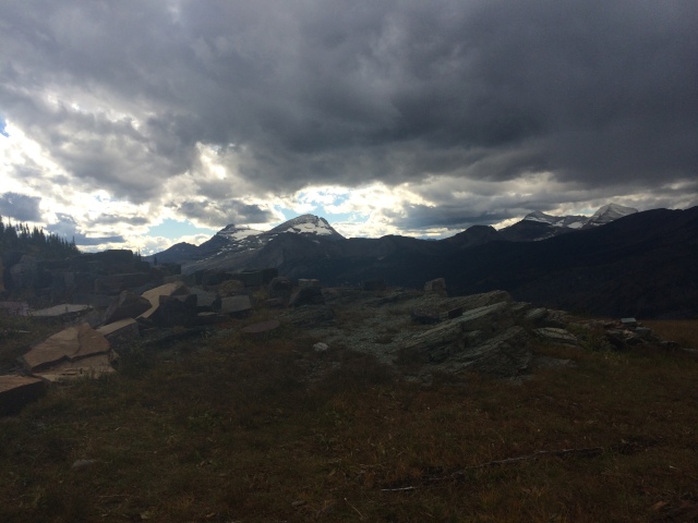
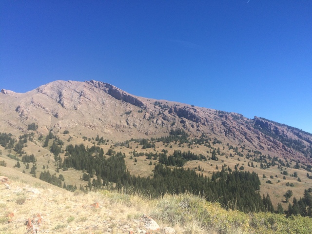
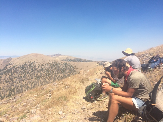
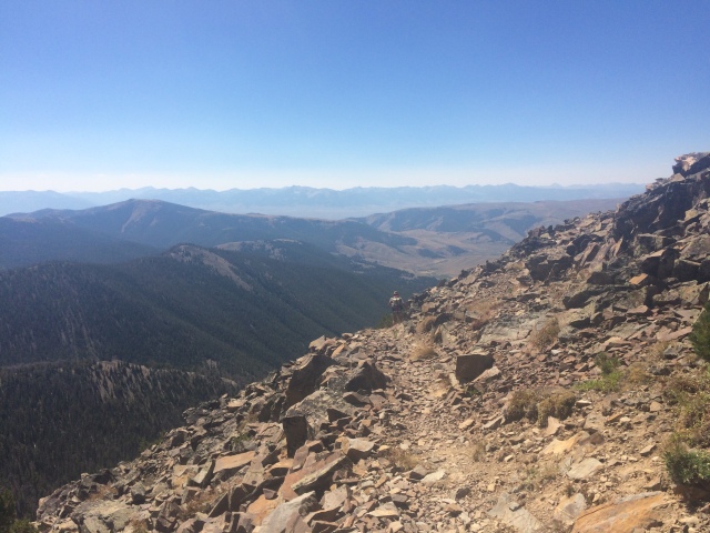
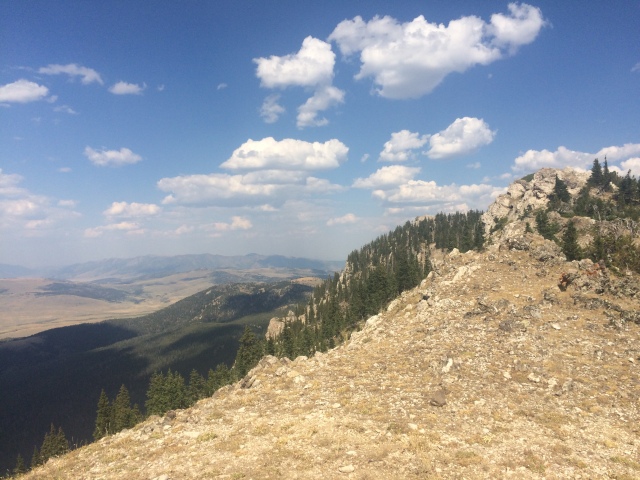
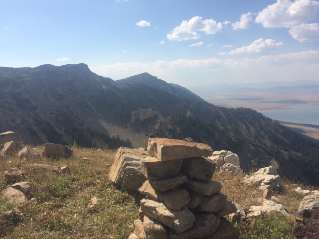
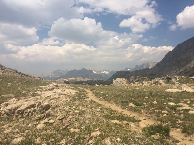
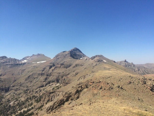
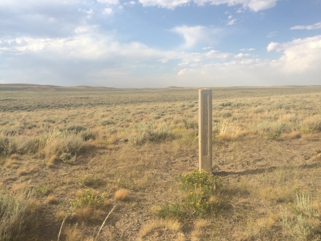
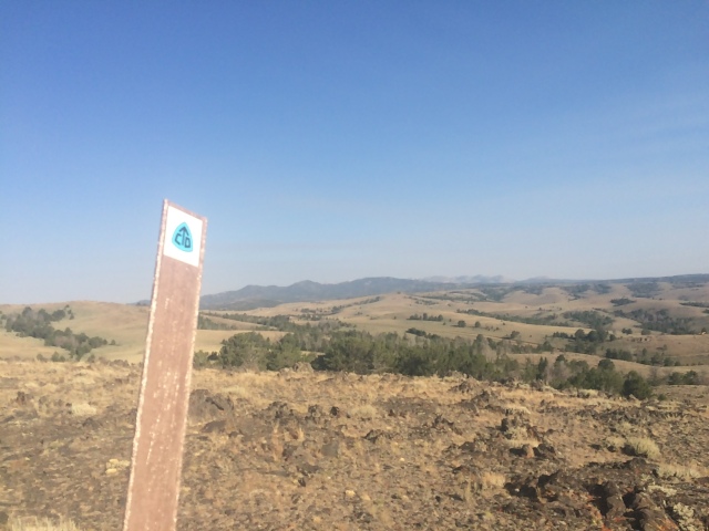
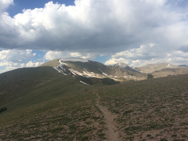
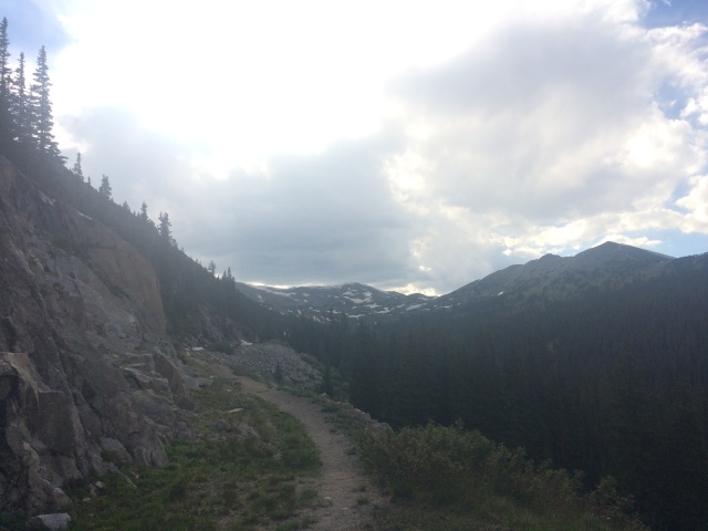
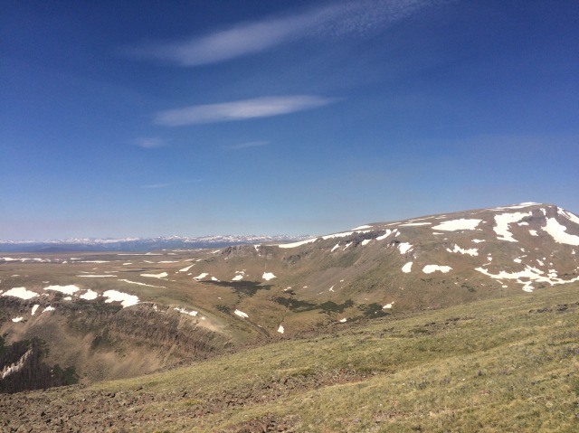
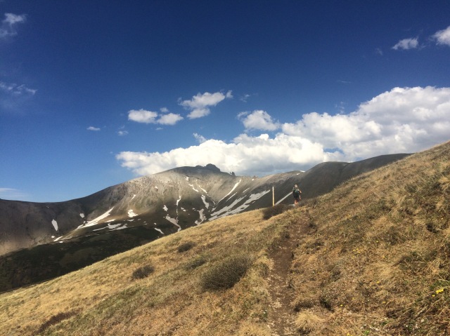
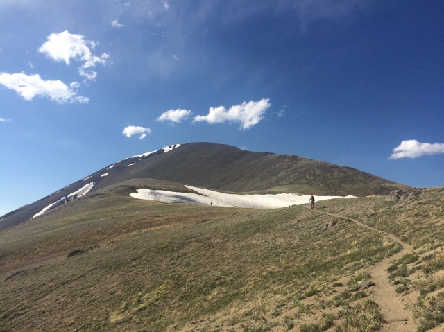
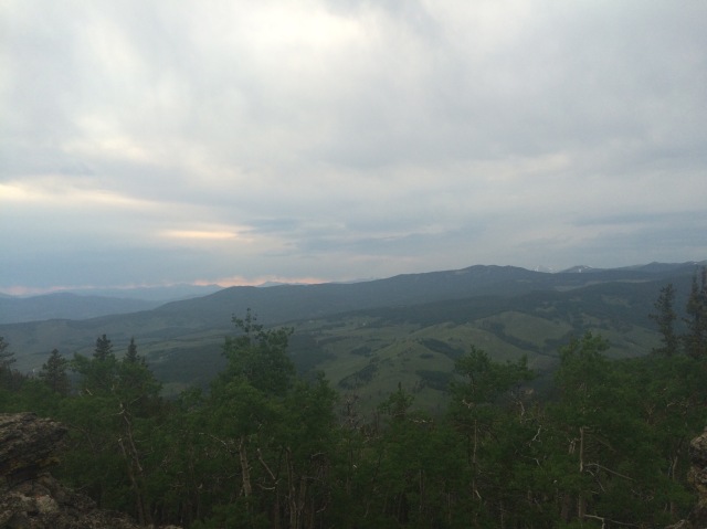
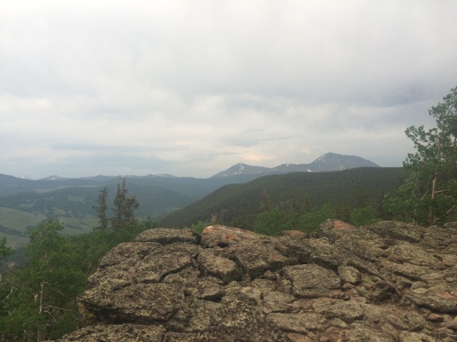
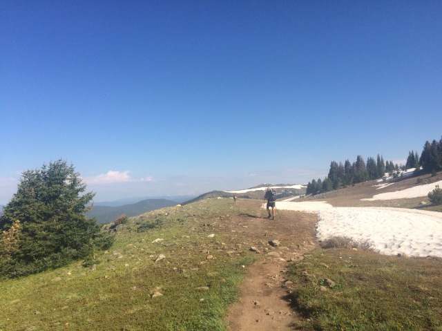
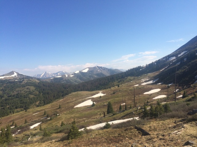
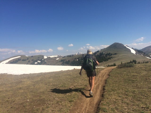
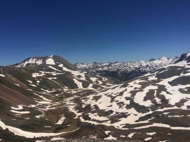
I stuck to what is called the “Ley red route”, the red line on the maps we have made by Jonathon Ley. It took me west and up to a cool rock formation called Hoadley Reef. Most other people (and I guess Cowboy, too), took the purple route to go through Benchmark Ranch. I walked that day alone and only ran into one older couple who were out for a few days. I climbed up to Hoadley Reef and over a pass. I saw a group of 5 bighorn rams. I’ve never seen rams before. That was cool. I got up to the pass and took a little break. As I stared out across the mountain sprawl, I had this idea pop up in my head: I should walk on top of the Chinese Wall. 

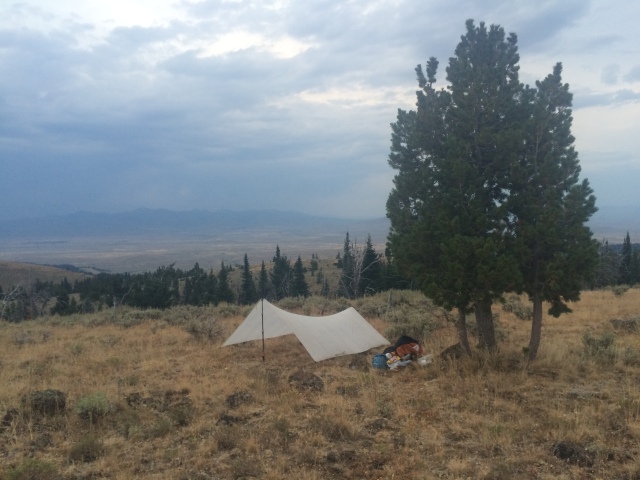
The Chinese Wall is a cliff of about 1000 feet that stretches 22 miles. That’s huge. The normal CDT route goes up under the base and walks the northern half of the Chinese Wall for about 10 miles. I looked at my maps and saw that there was a way to get up to the southern terminus of the wall. I reached that turn off at the end of my day up and over Hoadley Reef. I actually decided not to do it and walked past the junction, but I changed my mind 5 minutes later. “Fuck it, I’m never gonna have this chance again,” I said out loud and turned around. At the junction, I drew a message into the mud “Slingshot went” and an arrow pointing towards the west. If Cowboy was behind me (he wasn’t) then he’d know where I went. I walked up Indian Creek until it was dark. I found a sloped campsite and set up my tarp as the wind increased. I fell asleep to elks bugling, a crying scream that is hard to explain in words. I can’t even make that noise myself. It’s beautiful, so beautiful.

I woke up before light and almost bagged my Chinese Wall plans. I ate a poptart and packed up. As I walked back to the trail, I looked at the clouds lit up red by the rising sun and turned west. I was gonna do this. I already bailed on my Wapiti Ridge attempt heading over to the ranch in Wyoming. I seriously regretted that. I had to get up there and see if the Chinese Wall was at least do-able.

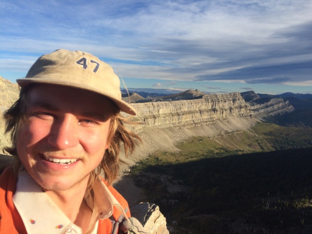
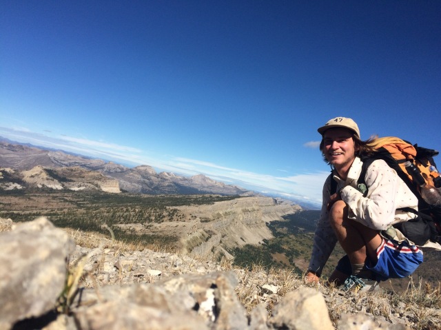
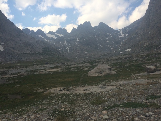
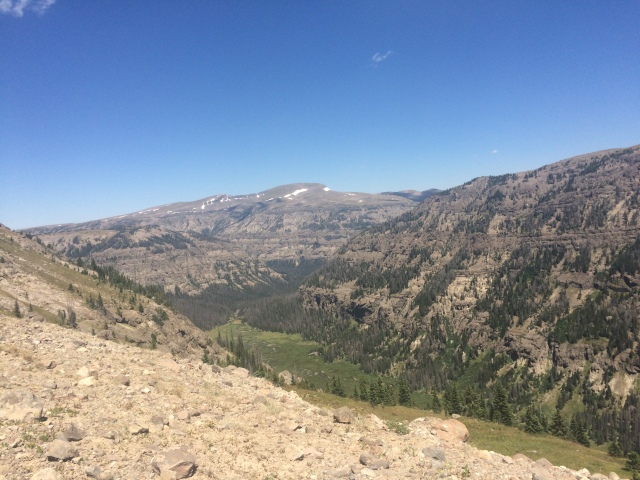
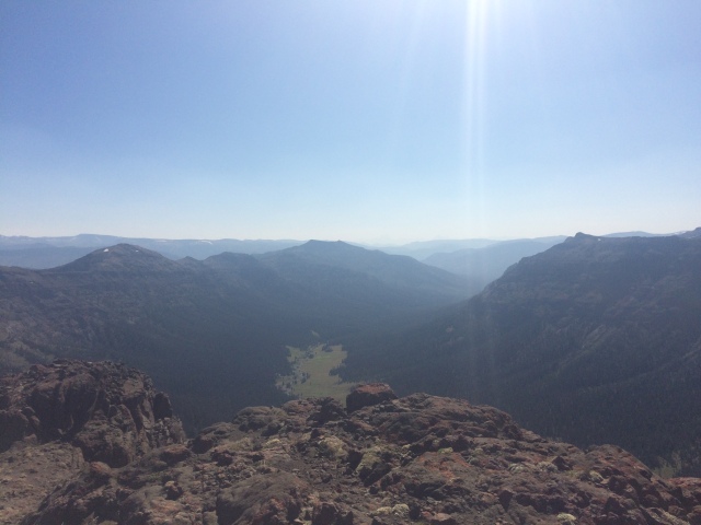
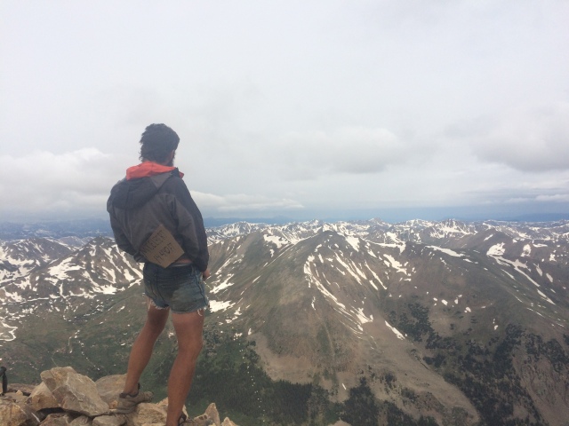
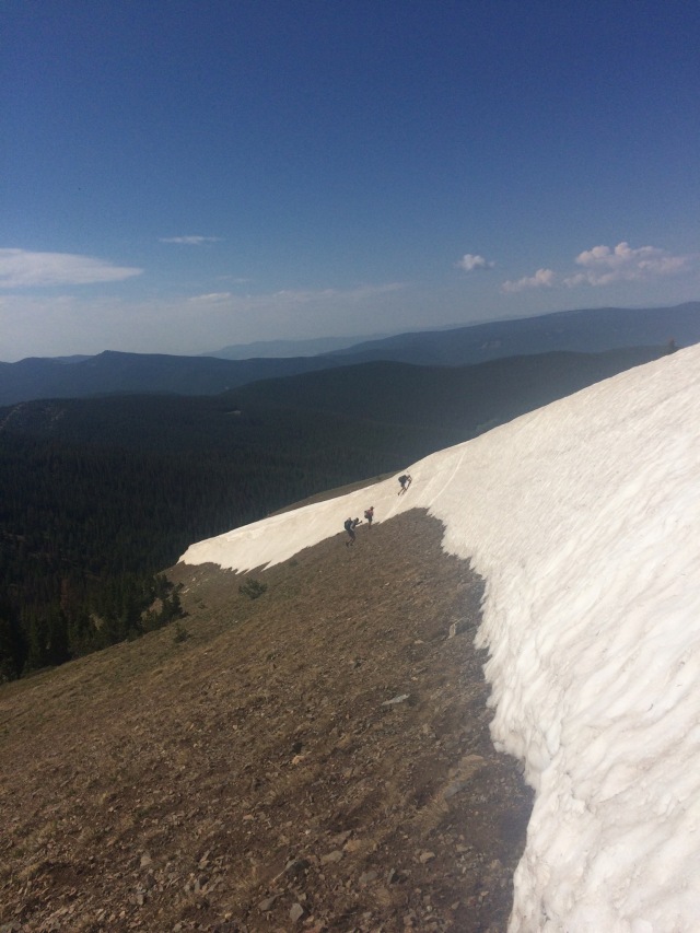
It was do-able… kind of. I had to scramble up a few cliffy faces in order to get up on top, but once I was past Haystack Mountain it was smooth sailing. That first view, when I got on top, took my breath away. That wall, the horizontal grey lines of different sedimentary layers, went a long, long way. I was walking that. “Yeah!” I yelled and set off. I had to climb down to the west a few times (the cliff face was on the east) to avoid some technical bits, but I walked along the edge for most of the wall. It was amazing. It felt so right. This was the most intense thing I have ever done on trail. It was so worth the effort. I saw some mountain goats. I saw some hikers down below me and yelled to them. They stopped and looked up, but I don’t think they saw me. I would later learn that it was Rampaige, Lucky, Handstand, and Boston Chris.

It took me all day to traverse the wall. The northern terminus was sketchy. There were two peaks before Larch Pass where I would rejoin the trail. I went up to the first peak and sighed as I looked downwards to the north. Getting down was going to be rough. I had the option of going way west, off map, in hopes of finding a trail that would connect me back up to Larch Pass, but I decided to attempt the sketchy descent. Big mistake. I found some mountain goat paths that took me down steep chutes filled with loose pebbles over bedrock. I had no sure footing. I grasped rocks and clung to occasional bushes as I crouched, crab-walked, and butt-slid down. I started breathing heavily. “What the hell am I doing?” I muttered. I found myself on a flat island in the middle of what felt like a cliff. I started down one way, but quickly stopped as rocks and debris that I loosened slid and rolled over what looked like a 50 foot cliff drop beneath me. I climbed back up to my little flat spot and sat down. I might be in a little bit of trouble here, I started thinking. Before I let myself spiral into a panic attack, I drank the last of my water and told myself out loud, “You’re here. You have to get down. Freaking out isn’t going to do anything. Calm down.” That helped. I walked back over to the chute I came down. It kept dropping to the east, toward the Chinese Wall face. However, it looked like there was some green space and some trees before the wall dropped off. There was a goat path down there. This was my only way down. I tried to swallow my fear and began my descent. I was on my butt as much as possible. I had to climb down a few 5 foot rock drops. Those don’t really sound bad or scary. They’re not, but I had a backpack on and was going down feet first, with my back to the ground. I threw down my trekking poles ahead of me and sort of had to hop down those little drops. If my backpack caught on the rock behind me, it could send me somersaulting forward and sliding down the 45 degree slope until I would eventually end up going off the wall and falling 1000 feet. One slip and I could die. That’s why I was scared and shaking and breathing and muttering, “frick, frick, shit, shit,” as I crawled downwards. My mind was blank. I focused on each footstep, each handhold. I made it. I was on a solid goat path that took me down the ridge a ways until I got to a place where I could descend to the west and away from those cliffy peaks.

It took a few minutes for the adrenaline to wear off. When it did, my legs started shaking, and I started thinking. I could’ve died. Actually. I’ve never felt so close to dying in my life before. In the San Juans, I had an ice axe for those intense traverses across icy slopes, a lifeline. Sure, I got scared down there, but the possibility of death never crossed my mind. Death is a funny thing. I always told myself I was never afraid to die. Death is inevitable and makes our short lives beautiful. So I thought. That changed after I came down off the Chinese Wall. I was scared. I didn’t want to die. I didn’t want to hurt. I didn’t want to face the infinite nothingness that could follow. I wanted to see my family. I wanted to laugh with my friends. I wanted a future. I wanted to hold a lover in my arms and never let her go. I wanted to close my eyes to the sound of music. I wanted to see the ocean again. I wanted to be a father, a grandfather. I’m not ready to die. I’m not ready to die. The tears started pouring down my face, and I collapsed to the ground. I could’ve lost it all. I’ll never forget that moment. I sobbed. I still haven’t quite processed it, and it haunts me as I write this.

Weak and defeated, I pulled out some nutella and started shoveling it into my mouth with my broken spoon head. I thought about how funny I must look: a dirty hiker, sitting in the rocks, crying, with nutella smeared all over his hands and mouth. I laughed. I have to keep moving.

I walked the rest of the way down to the west and had an incredibly claustrophobic bushwhack to the trail I was looking for. I finally made it back to the CDT and checked my guthook gps app; I had only done 18 miles over the course of nearly the entire day. I had some catching up to do, so I hiked down the Spotted Bear River until it was dark. I found a spot by a river crossing. I plopped down and spread out my stuff. I ate dinner and fell asleep as daddy-long-legs crawled over me. I used my food bag as a pillow. I’m too lazy for bear-hangs. I got through the Thorofare without hanging my food despite seeing two grizzly bears, so I figured I’d be fine now.

I got up early the next morning and pushed it. I passed a few hunters who said a group of hikers were nearly 2 hours ahead of me. Must be Rampaige, Lucky, Handstand, and BC. I kept pushing up and over a pass. I stopped for a brief lunch, consisting of cold bratwursts and cheese sticks, dipped in mayonnaise. It was yummy then, but I gag at the thought of it now.

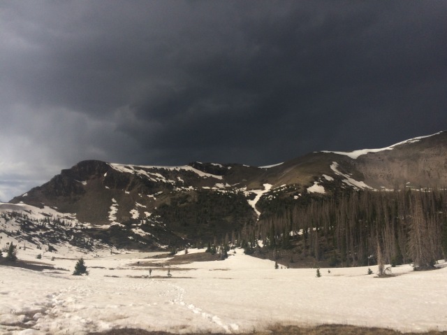
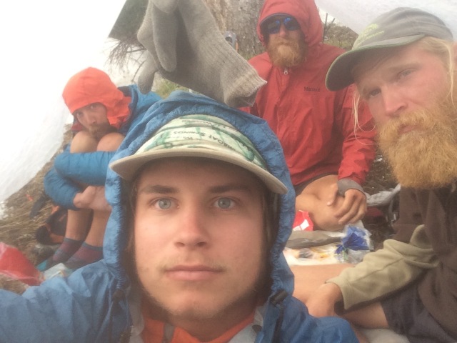
It started raining that afternoon. I eventually made it to a ranger cabin (they’re all locked up) and made coffee on the porch as I watched the rain turn to snow. Not again. I still had a ways to go before East Glacier. I spilled my coffee. Ugh. I got up and walked as the snowfall grew thicker and wetter. Plants hung over the trail, weighed down by water. I walked through them as they painted my shorts and thighs with frigid water. I felt stupid for not having rain pants. I had long underwear, but I wanted to keep them dry for sleeping. My gloves were wet, and my hands were cold. I eventually made it to a good campsite where Lucky, Rampaige, Handstand, and Boston Chris were camped. Everyone was holed up in their own tents as I pitched mine. We all told each other how cold and wet we were. “The hunters said it should clear up tomorrow,” someone said.

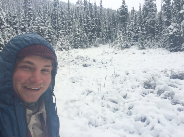
It didn’t. I woke up to a winter wonderland for the second time. My tarp was coated with condensation on the inside and ice on the outside. My sleeping bag was damp along with my pad and groundsheet. I groaned. I moaned. Then I undid my neoair and let the air rush out of my pad; I had to get up and keep moving. If I didn’t move, things would get worse. I slithered into my cold, wet shorts and packed up.

“Slingshot, are you really getting up right now?” Rampaige called out from her tent. I replied yes and told her that I was just trying to get as far as I could because I was running out of food. I only had enough for an unsatisfying day and a half. Luckily, everyone demanded I take some food because they had too much: Rampaige gave me breakfast shake powder with chai in it, Lucky gave me some tuna and a peanut candy bar, and Handstand gave me some nuts. That ended up helping a lot. Thanks guys.

I set off on my own in oddly similar conditions to the snow day between Helena and Lincoln. I walked on my own through most of the morning until Handstand caught up with me.

“Looks like it’s you and me in the snow again,” I laughed.

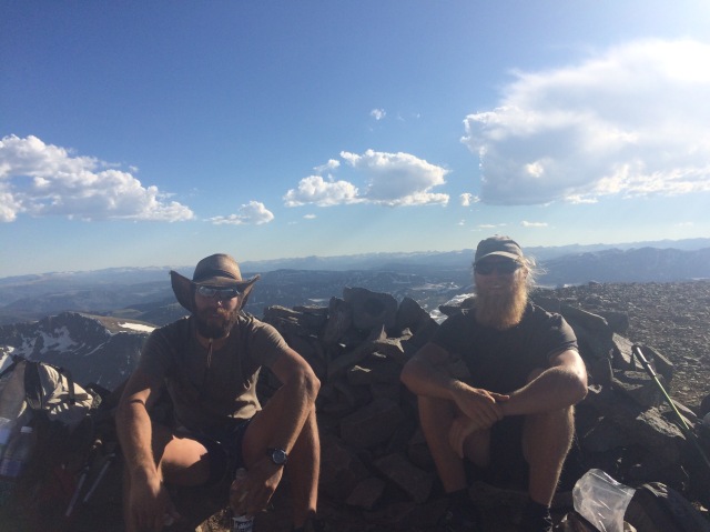
“Yup, let’s do this,” Handstand replied. He was a great hiking partner to have when the going got tough, and I really enjoyed his company. I had the pleasure of finishing the trail with Handstand along with Cowboy Stripper and Boston Chris.

We walked through the snow, always moving to stay warm. Just like the previous storm, the snow sort of subsided in the afternoon, and we even saw snippets of blue sky. Still, it wasn’t good enough to dry out our stuff. I was worried. Tonight was going to be cold. The weather report when I was in Lincoln said that this night would be well below freezing. Wetness and freezing temperatures are a terrifying combination to thru-hikers who only carry enough stuff to get by.

Luckily, Handstand and I made it to a patrol cabin where two wildlands firefighters were staying. It turns out they were fighting a small fire in the area before the snow hit and put it out. Now they were stuck here and hoping to get their 4-wheeler out in the morning. They let us come in to warm up around the wood stove and dry out some of our gear. Unfortunately we weren’t allowed to sleep on the federal property. Bummer. Still, drying out our stuff was a huge help, and we confidently found a spot to camp.

It really was cold that night. Luckily all my gear was dry(ish), so I stayed plenty warm. It was just very difficult to get up in the morning. I eventually sucked it up and started walking with all of my clothes on: shorts underneath my long underwear, my shirt, fleece, puffy jacket, tattered gloves, and beanie. The sky was the clearest blue I have seen in weeks. It was beautiful. The trail was frozen at first with snowmelt, but as it heated up it quickly turned muddy and slippery. I ended up taking the official route up on a trail that no one had walked the previous day in the snowstorm, so I had to make all of my own footsteps in the snow and continuously pay attention to where I thought the trail was going. I encountered some bowhunters up there with gigantic packs. Then I ended up missing a junction right before Marias Pass and ended up way down on the highway below it. I decided to just walk the highway into East Glacier. It was simpler, I was sick of wet, muddy trail, and I really wanted to get into town after a long, grueling stretch. Handstand made the same decision and caught up to me a few miles down the highway. We made it into East Glacier and celebrated with a delicious bacon cheeseburger from Two Medicine Grill followed by some huckleberry pie.

Reunited with Cowboy Stripper, we stayed at Brownies, a hostel. I had an extremely uncomfortable top bunk, but it was lightyears better than what I had just endured in the Bob. We ended up taking a zero the next day for some extra recovery and to get our permit for our campsites through Glacier National Park. We were slotted to finish on September 19. It was really happening.

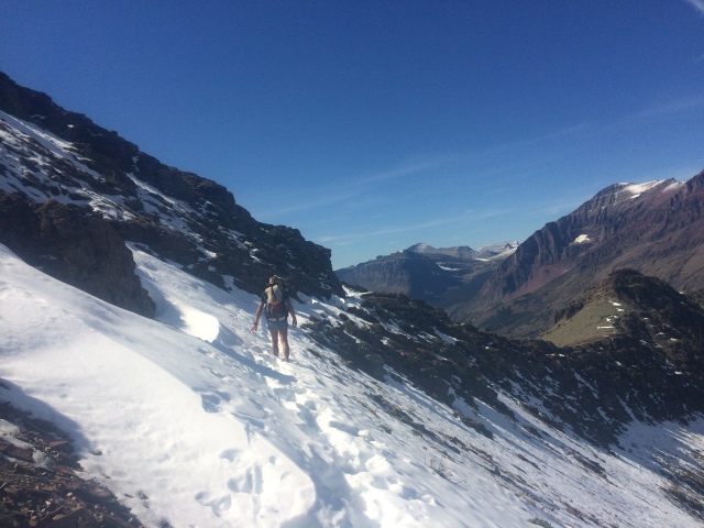
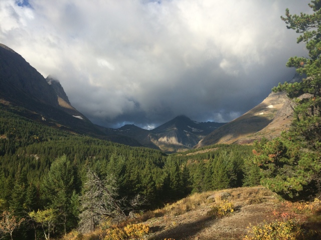
That last trip through Glacier was remarkable. I’m so glad I stuck to a northbound hike because ending in Glacier was more epic than I could have imagined. Those mountains are feared! Maybe even ultrafeared…

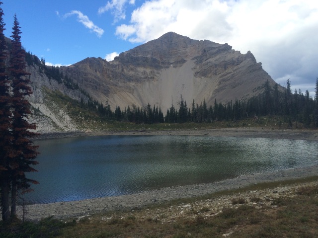
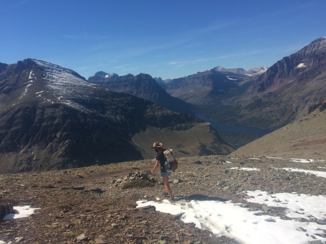
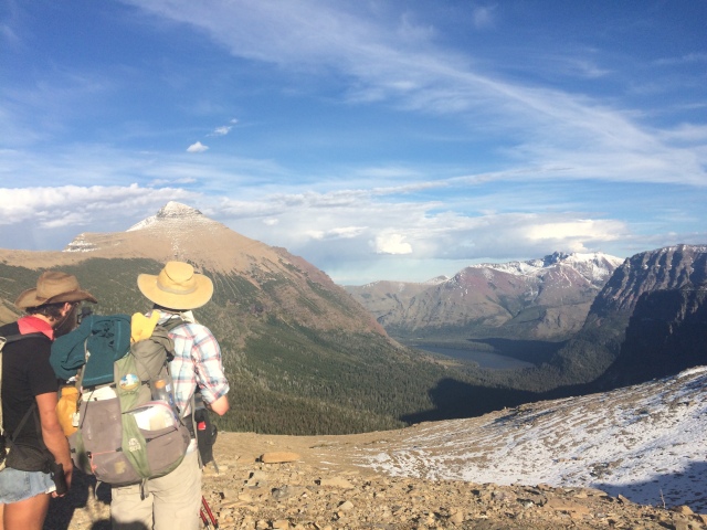
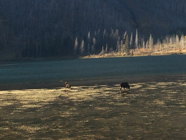
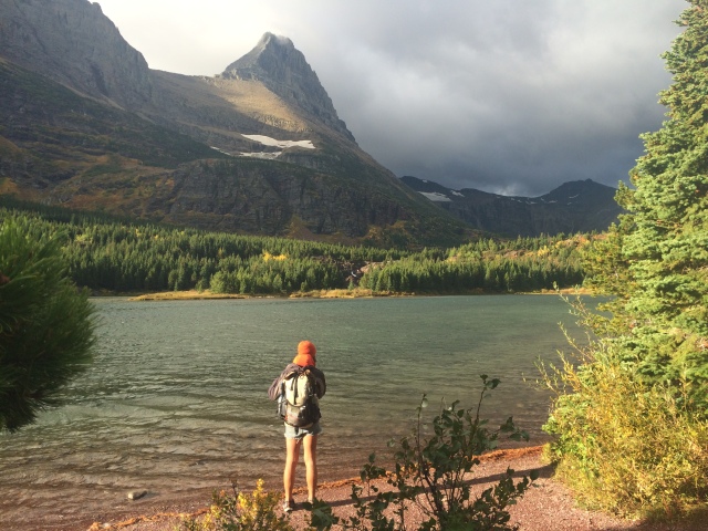
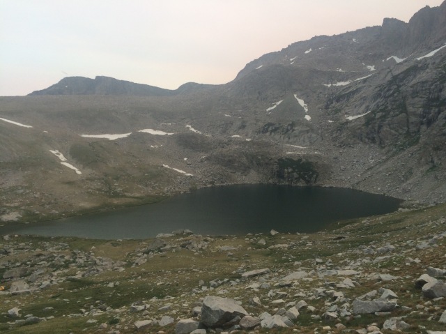
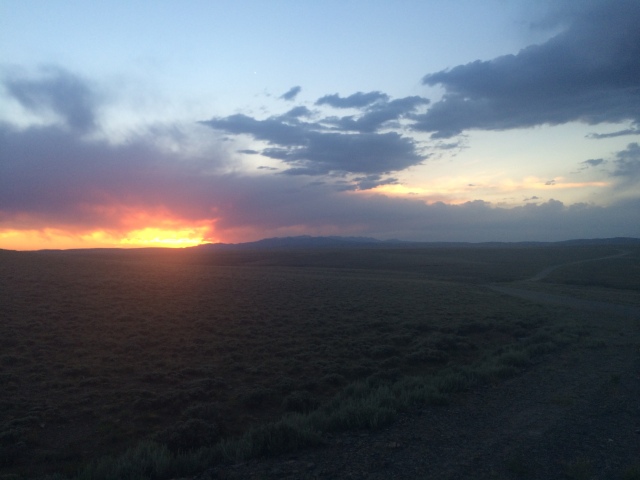
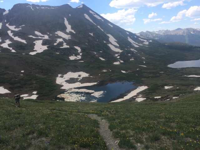
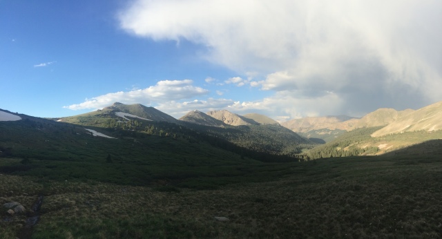
Our first two days were magnificent. The weather was warm and clear. Our first day was a big one, and we climbed way up high over a pass and took a high alternate that traversed the western side of the continental divide. The lingering snow made the walking a bit more technical that I thought it would be. The extra miles, extra elevation gain, and late start made for a night time arrival at our campsite. As we prepared dinner, Handstand pointed up and shouted, “Woah!” A comet soared across the sky from horizon to horizon. It was amazing. I wished for the same thing I had already been wishing for months whenever I saw a shooting star. The second day was chill, or chilean seabass as some say. We only had to do 15 miles up and over Triple Divide Pass, where the Pacific, Atlantic, and Hudson Bay waters parted. Neat! We ended that day at a lake where we saw a mama moose and calf grazing in the water.

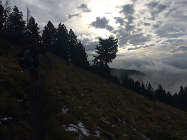
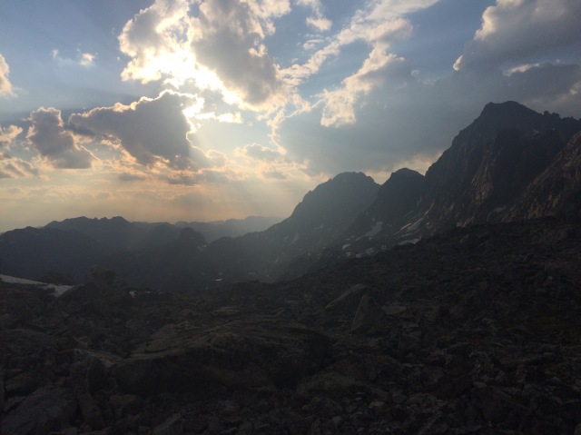
The next day was grey and dreary. Rain was surely coming. The morning went by quickly, as it should have since we had 30 miles to do that day into Many Glacier. Around lunchtime, we crossed the Going-to-the-Sun Road as it began raining. It really came down, and we had to climb up and over the huge Piegan Pass before getting to Many Glacier. The climb up wasn’t too bad, but once I got over the pass, the wind began. I’ve never been in wind that bad. It must’ve been consistent at 40mph with sustained gusts that reached and went well over 80mph. Water found its way into every little rip and tear in my rain jacket. The water ran down my pack and soaked my butt. I’d try to step up over a rock on the way down from the pass, but the wind would blow me sideways to the point where I was involuntarily stepping multiple times before planting my feet in an athletic stance against the wind. I screamed into the wind at the top of my lungs. I was on the verge of crying from the absurdity of it all. Every now and then, the rain would turn to hail and sting my face if I looked up.

Miserable and hysterical, I ran down the pass into tree cover. That helped to curb the wind, but it was still dumping rain. I worried about my gear, especially my sleeping bag. It was in my trash compactor bag liner, but I lost my waterproof stuff sack down near Salmon, ID. At least we were going to be in Many Glacier that night.

I made it to a little shelter thing where I found Cowboy, wet and downcast like me. “Everything is wet. I’m completely soaked. This is ridiculous,” he said.

“Me too, my rain jacket didn’t really work to begin with,” I replied.

We hiked around a lake and eventually made it into Many Glacier. We headed for the restaurant where we saw Handstand and Boston Chris dripping wet at the bar. I ordered a hot chocolate and buried my face in my hands. How was I going to make it to Canada on the route I wanted to go? It was supposed to storm tomorrow, too. High wind advisory. There were no rooms available tonight. The campground was pretty badly flooded, and it was still pouring outside. Ugh. I went outside and checked my sleeping bag; it was wet. Shit. I went back inside. I got wifi and exchanged texts with my friend, explaining my situation. She sent me words of reason and encouragement and also made me laugh about something from her day. I don’t think she realized how important her words were to me. They gave me something to hold, something to look forward to.

We bought laundry tokens and threw all of our wet gear into the dryer. I took a steaming hot, 8.5 minute shower. Ah, much much better. We decided to sleep on the bathroom floor at the trailhead. It was warm and dry, and nobody was going to go there at night. I reached a new low. We redefined the definition of hikertrash. And it felt good. It felt so good, despite waking up to the view of a toilet bowl three feet from my head. That was kinda gross.

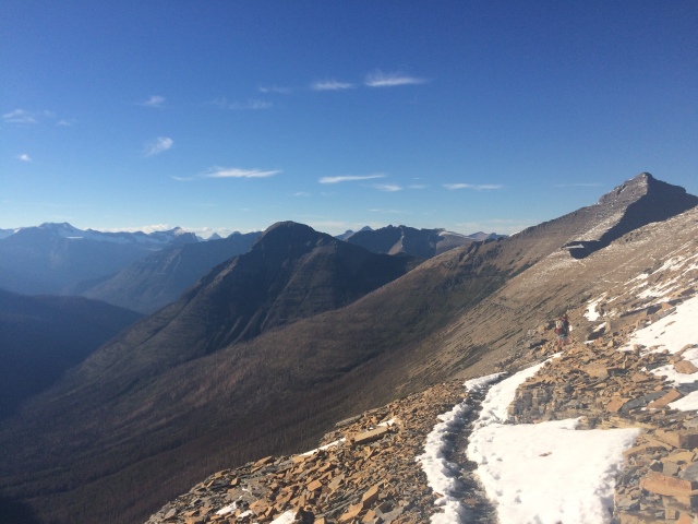
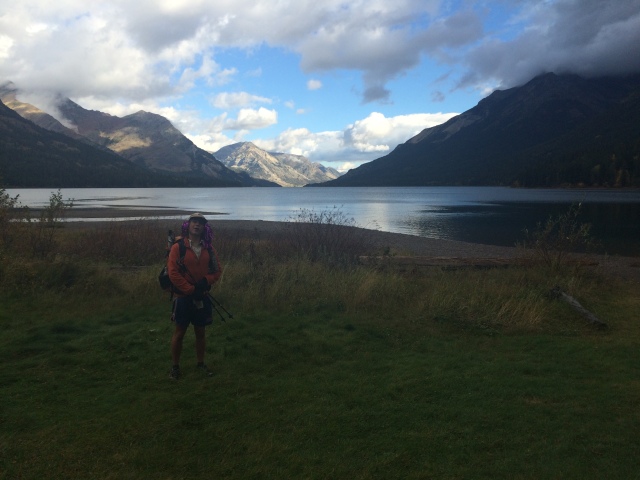
The weather the next day wasn’t that bad. We climbed up and over another pass and got on the highline trail on the west side of the divide. There were lots of stormy clouds, but we would get little waves of light rain and light hail — very manageable. We made it to our campsite that was only 7 miles from the border after a gorgeous day of hiking and even seeing a wolverine. It was a great last campsite right on a lake. We had a fire. I made a delicious trail dinner. I read Shantaram into the night and slept well. I had hot nutella cocoa for breakfast and set off for the final miles of the CDT.

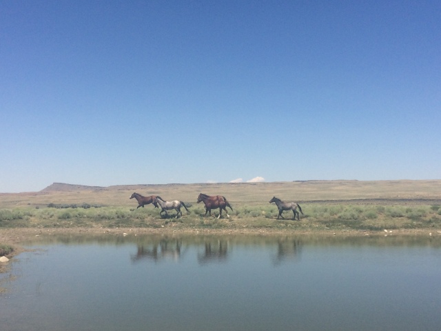
I wish I could tell you about some profound inner dialogue I had through those last hours of hiking. Like the rest of the trail though, I didn’t think much, and I didn’t think much about not thinking much. Sure, I thought back through the whole trail: meeting Cowboy before Lordsburg, wading through the Gila, fun times at the Toaster House, the desert beauty of northern New Mexico, the epic beauty of the snowy San Juans, good friends throughout Colorado, setting off on my own from Steamboat through Wyoming, wild horses in the Great Divide Basin, the Wind Rivers, soloing the Thorofare to Rimrock, hiking with Zoe and Mary-Clare through Yellowstone and Eagle Creek, catching up to Cowboy before Leadore, aqua-blazing to Darby, walking the Chinese Wall. Those memories were with me and will never leave me. Still, I didn’t linger on them long. My mind was filled with the thought of getting to the border and what was next. I was seeing Boz in a few days. I was going home. I was going back to school. I was planning my next hike.

What I’m about to describe might not make sense, but I want to try to explain it, at least a little bit. Walking the divide, I reached a special state of mind. When I walk, my mind shifts into a different gear. It hums. It’s simpler. It does not worry or think too deeply about meaning and purpose and life. It sees the path in front of me and all the beauty around me, swallowing me. It dwells on good memories, on smiles, on laughter, on love, on green eyes, on morning sunlight. It is utterly present yet also hugs my past — the people who love and support me — and feeds on my potential future.

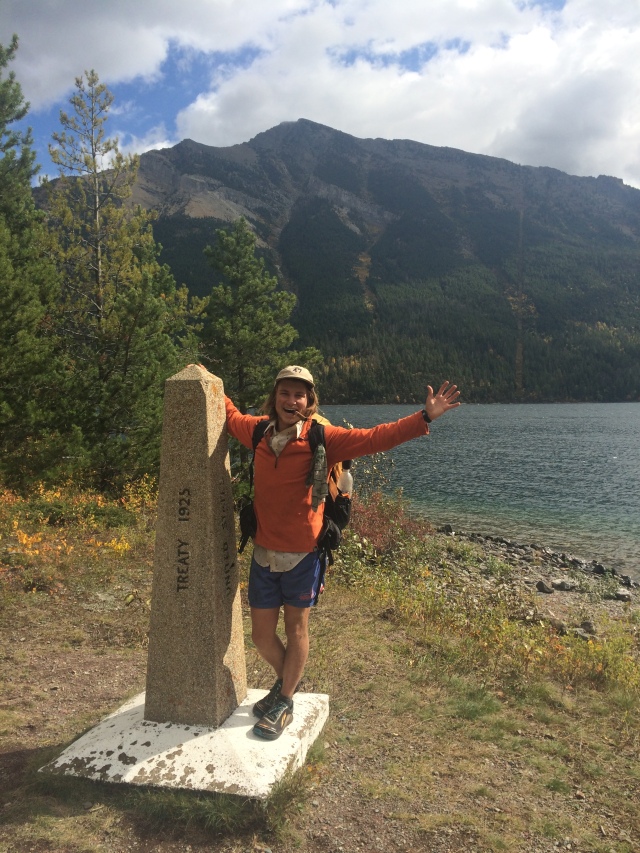
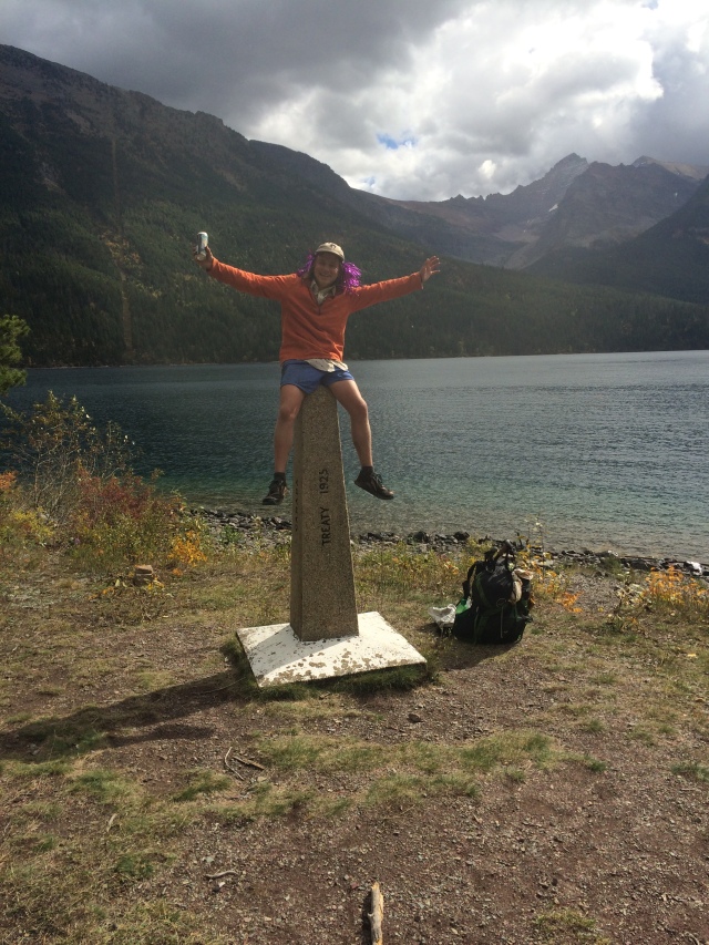
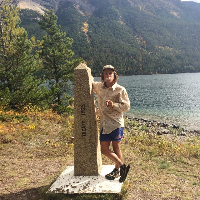
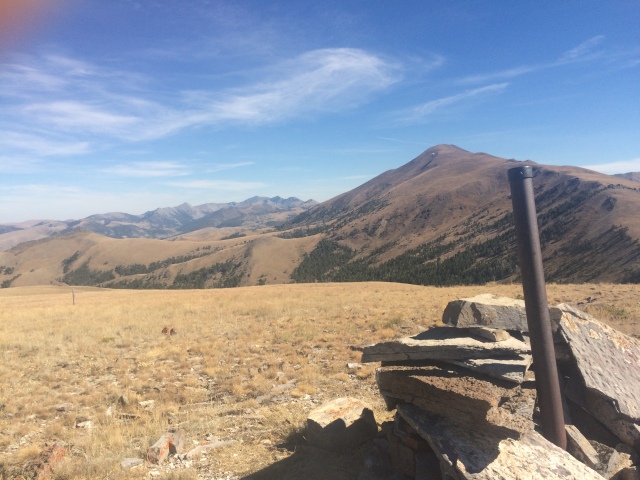
I made it to the Canadian border around noon on September 19 and hugged my hiking comrades. It felt great. I set out to accomplish a goal, and I did it. That’s cool, I guess. I felt a little numb and overwhelmed at the end. It’s hard to process 2700 miles of your life. I probably won’t make sense of it all for a while, but I’ll try. Maybe I’ll figure it out on my next hike, which I’ve already started thinking about.

To those of you who have followed and read my story, thank you. It means so much to hear that people enjoy and are inspired by my adventures. I definitely encourage going on a long walk. Thru-hiking taught me so much. At the same time, there are so many different ways to capture the spirit of a thru-hike in everyday life. Hug your friends. Cherish good food. Help out someone who is having a bad day. Think about the next step forward. I’ll be trying to do the same thing.

Love,

Slingshot


I’ve written a little poetry on trail and thought I’d leave it here:

I’ve learned the smell of aspen trees

I peer into their eyes of broken bark

their hearts on display

I’ve learned to see again

their bright green hands

unlike my body

drink the rain and dance the wind

they live together

one

they love

even me and my loud footsteps 

planted in the dirt

head down

they watch me


another one:

I’m nowhere closer to the man I want to be

to the boy I was

I’m nowhere closer to the secrets of the universe

or why we fear death

I haven’t discovered the secret formula to happiness

except, maybe, a snickers at 10:10 or a dreary-eyed sunrise

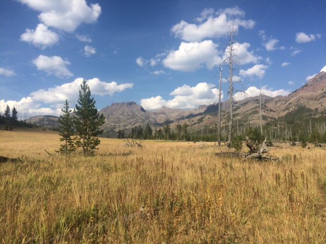
a stubborn pine tree in the middle of a meadow

a towering jagged peak

i’m small.

and nowhere closer to where it all began

but I am here, now, and that’s all there is

maybe all I need

all I want


an appropriate song:

“It’s gone away in yesterday
Now I find myself on the mountainside
Where the rivers change direction
Across the Great Divide”

– Kate Wolf


video made by Handstand, from East Glacier to Canada

image
Handstand having fun in the snow
image
I really did smile all day it was weird

image

image
Hey there cowboy
image
Meltage in the afternoon
image
Above the clouds
image
Sitting in the back of the sheriff’s truck headed into Lincoln
image
Entering the scapegoats
image
Weeeee
image
After getting nailed by sideways hail and gusts super exposed
image
Much warmer down lower
image
5 rams!! So cool
image
View from hoadley reef
image
The start of the Chinese wall!
image
Timer photo fail
image
View of the Chinese wall from cliff mountain
image
More wall, at some point I was yelling down to rampaige, lucky, handstand, and Boston Chris
image
More Bob Marshall beauty
image
It’s happening again
image
I was happily cold?
image
Lots of bear tracks out there
image
Handstand and I pushed it to east glacier together
image
Cowboy Stripper is known for his hat
image
Glacier epicness
image
What is this, the Sanny J’s?
image
Legs and a view, sums up my pov
image
Taking it in
image
Super stoked we went around this side of the divide
image
Got to see this bighorn
image
I thought this was cool
image
One of my favorite peak shapes
image
On the way to triple divide pass
image
Other side of triple divide pass
image
Mama and baby moose
image
So many waterfalls
image
Stormy clouds leaving many glacier
image
Fall colors
image
We have to go up there?
image
Views on the highline
image
This wasThe last legit up on the CDT
image
Pictures of picture taking
image
Heavenly clouds just before descending into Waterton valley
image
Pretty large
image
Goat haunt ranger station
image
The lake we walked along in the end
image
Yay!
image
More yay! With purple hair and beer!
image
My professional CDT ending photo, featuring the Cuban Zoe gave me

getting there

Well I’m sitting in the luxurious Budget Inn, here in Helena, watching TV, drinking coffee, and resting my legs and feet. It’s my first zero day in a while (since Club Brooks in Wyoming), and man, does it feel good.
The last two sections have been great. Darby to Anaconda turned out to have some beautiful lakes and passes. Walking through Anaconda involved lots of miles on a highway, but that’s okay. Cowboy and I ended up walking in at night, stopping at bars along the way, only to discover the motel office where we were gonna stay was empty and unresponsive. We ended up sleeping behind a bowling alley… didn’t get much sleep. Not one of my prouder moments. I got a new shirt, a long sleeve button up with little logos of confetti-kabobs all over it. It’s pretty sweet. The next section to Helena (Macdonald Pass) went smoothly. The forests we walked through were gorgeous, and the foliage on the ground was starting to turn crimson and orange. September 1st clicked by. We had a stand off with some cows at one of our campsites. Good times.

I now have about 360 miles until the Canadian border. I’m still processing that. I can only really say it out loud, look at my watch and count down the days. Still, no matter how much I think about flying home on September 26 or getting back to Claremont in October, I can’t escape the present. That’s the beauty of the state I’m in after walking so many miles. In the words of Calvin Garay, I am truly “here, now”, and I love it.

some lyrics I’ve been listening to a lot by Dawes from “My Way Back Home”:

I admit that these answers that I seek
Are the questions I’ve never known
But I plan to keep on looking for as long as I can roam
And when the world finally fulfills me
I will not forget my way back home


where the wind hits heavy on the borderline: mt/id

I was still playing catch up to Cowboy Stripper on my way out of Lima. He left the morning I got into town, and I didn’t get back on trail until 6pm or so. I had about 20 miles to make up at least over 4 days.

The section from Lima to Leadore followed the border — the divide — for about 100 miles. Most of the time it was actually right on top of the divide, which turned out to be a real roller coaster and leg burner. I still thought it was gorgeous and managed to catch Cowboy along with some other cool hikertrash before heading into town. I also experienced a whiteout, sideways, 50mph, freezing mist storm for an entire morning. It’s actually way more fun that it sounds.

From Leadore, we actually had to skirt around a fire closure (which turned out to be lifted by the time we went through). We did about a day and a half on trail then dropped down to the highway for 65 more miles. By chance, we got a free stay at this couple’s bed and breakfast (amazing!! Probably the most generous thing to happen). We then realized that the Salmon River paralleled our highway for about 20 miles, so we rented  raft and “aqua blazed” for a day and a half. Wow that was fun.

Sorry this is a bit hasty, Cowboy and I are already hitching back out of Darby after a few beers from the smallest brewery in Montana and too much pizza.

We have less than 550 miles left! Gee wowie.

imageimageimageimageimageimageimageimageimageimageimageimageimageimageimageimageimageimageimage

somewhere along the way: adventure buddies, Yellowstone, eagle creek, club Brooks, and borderlands to Lima

The past week and a half or so has been an absolute blast.

I met Zoe and Mary-Clare in West Yellowstone as I was getting our permit to hike south through Yellowstone. Unfortunately many of the campsites were booked so we took two campsites that were super far apart… Not sure if we would make it or not…

We hitched a ride in the back of a pickup to Macks Inn where we started hiking south into the park. What a weird feeling to be going the wrong way! Those first miles were on a road and dirt road for a while, a nice dose of road walking boredom and word games as an introduction to the CDT for Murc and Zo. The next day we entered the park and started running into northbounders I hadn’t seen since Colorado. Pretty cool!

Along the way, we came up with some trail names: Lemondrop for Mary-Clare and Slothbaby for Zoe. They stuck pretty well.

The terrain in Yellowstone before we hit Old Faithful was pretty flat and burnt, but Summit Lake was a nice campsite (not technically our campsite but we didn’t see a ranger). Old Faithful was pretty neat, I’ve seen it before so wasn’t geeking too hard like all the tourists around us. I actually really enjoy people watching in national parks. Yellowstone is gold for that.

That night we ended up illegally camping again with a barefoot hiker who had a run in with a huge grizzly. Yikes. We didn’t wanna walk through that area in the evening. We ended up walking into Grant Village the next afternoon where we spent the night.

From there, instead of hitching back to West Yellowstone and heading north to Lima, we decided to go east, hike down the east side of the lake and over Eagle Pass back towards Cody, where we would meet up with Slammin Sammy Brooks and Ian to hang out at Club Brooks for the night.

Taking that route turned out to be a great decision. We had two amazing campsites, one by the lake and the other way up high under the pass. We crossed over and walked through Eagle Creek meadows where I had wrangled on a pack trip three years ago. I can’t get over how gorgeous and unique the Absaroka mountains are. Not many people go back there too, which makes it even cooler.

After three days of tough hiking, we made it to the north fork highway and got a ride from an older Cody couple. Sadly, I snapped my guitar neck by accidentally shutting the trunk on it (I guess the pack wasn’t all the way in the trunk). I’m incredibly bummed.

However, our moods were quickly uplifted as we walked into Club Brooks to find Sam and Ian awaiting us with a stocked fridge and the porch ready for ultimate chilling. It’s the best porch ever. It overlooks Jim Mountain and you can sit out there and talk all day and night in the presence of Wyoming beauty. Thanks again for the hospitality, Club Brooks. I owe you one!

The next day, Sam dropped us off in  Fishing Bridge where we hitched across the park to West Yellowstone. Just like that, a week later, I ran across the street to hitch back to Macks Inn and parted ways with Slothbaby and Lemondrop who were headed back to Bozeman. It was so awesome having y’all adventure with me for a bit. I had a blast and hope I didn’t cause too much blisterful pain on our 115 mile trek… See you in Claremont along with the rest of the #fam.

Heading out of Macks Inn was confusing. I was pumped to be hiking north again but was already missing my adventure buds. I was also feeling a bit homesick and ready to get back to Claremont. After climbing up to a ridge and breathing in that smoky, fresh air as I looked out for miles in 360 degrees, everything felt ok again. I’m ready to walk the rest of this trail and enjoy every moment of it.

Still, things are different. I finally feel like I’m walking towards something and not away anymore. I’m walking to my friends, to my family. Home, wherever that may be. As I rest up in Lima with a few other hikertrash friends, I know that I wouldn’t be here without them. It’s amazing how much we understand each other, our relationship with the trail and the outside world. I’m pretty happy right now. Too happy for my hasty words to explain.


image

image
Am I a SOBOer now?

image

image
yay team

image

image
Sup Zo

imageimage

image
#squad rolling thru

imageimageimage

image
Yellerstone lake lookin all pretty

imageimageimageimage

image
Up near eagle pass

imageimage

image
Mandatory Club Brooks banquet selfie with SlamminSammy
image
Pretty bummed out about this
image
New fire near west yellowsone

imageimageimage

miles, mountains, bears, and tears through the Winds and Thorofare

Whew. What a walk!

My route through the Winds and off-CDT expedition through the Thorofare to Rimrock Ranch took me about 11 days, and they were some of the most intense hiking days of my life. Ha, I feel like I’ve said that multiple times on this journey: the San Juans, the ridiculous ridge walks north of Breck, and now these two mountain ranges.

They’re very different, the Winds and the Absarokas. The Winds are super granitic, and you often find yourself staring up at huge hunks of rock and spires and towers and alpine lakes so blue. There are a decent amount of backpackers up there, too. I didn’t see any NOLS crews, but plenty of people were out there for a few days near Cirque of the Towers and Gannett Peak (highest peak in WY). The lakes and streams were full of trout. The flies and mosquitos got close to unbearable around dinner time, but I didn’t care I was so tired.

In order to keep to my schedule, I was pushing a 28 mile per day average through the Winds. It was tough, especially considering I was taking two very steep alternates through Cirque of the Towers and one over Knapsack Col. I highly recommend walking them if you find yourself in the Winds — they were breathtaking (both by their physical demands and their beauty).

Through the Winds, I was pretty much on my own, but sort of bounced around with Handstand in the beginning and Shortcut throughout. I camped alone every night. I was pretty beat up after doing huge miles through the desert with no rest. My big toe joints were swollen from the heat and miles and maybe from my arthritis (I really do have arthritis it’s weird) and rubbed against the tops of my shoes. I ate ibuprofen twice a day. I had a pretty bad blister on my left toe joint.

None of that stopped me from recognizing this little solo-venture of mine to be one of the most important and unique parts of the trail in the grand scheme of things. More on that later…

I woke up and tried to start walking before 7am everyday, finding it more difficult as each morning passed. I walked with few breaks except to eat or filter water or stare and say “how neat is that” out loud. I cold soaked my Knorr’s rice and ramen mix around 5, stopped to eat around 7, and walked until 9 or so every night. I set up my tarp half of the nights and always had to wrap my head up in my rain jacket with a little deet to prevent getting eaten by mosquitos.

The walking was great. I was never bored with amazing views around each bend. The trail was in good shape.

Getting over Knapsack Col by myself around 7:30pm at the end of a long day was a pretty big moment for me. It’s basically a little notch of a mountain pass and a way for mountaineers to approach Gannett Peak and others in the area. On the east side, my ascent, I had to scramble up an enormous boulder field and around some snow. I was moving slower than 1mph and using my hands to shimmy-shuffle and slide up them big ole rocks. It was a pretty fun challenge, and it wasn’t that sketchy, considering granite is so grippy and solid (unlike the Absaroka breccia…).

Reaching the top and looking west, I raised my eyes toward the lowering sun, framed by massive peaks. Rays of light shined through soft clouds, those clouds which held so much power out here. I felt so small. Yet, I gained a new sense of hope and came closer to understanding, for a moment, what’s drawn me out here and why I find the need to walk this trail. I looked to my left and right, disappointed that Cowboy or RightOn wasn’t there to say “dude, this is amazing” and then crack a joke about how tired and sore we were in the presence of such sublime beauty. I felt my chest tighten up, and I swallowed a knot in my throat. A dry tingling rose up behind my nose and eyes. I began to cry. I started to sob and smile and laugh like a maniac, wiping the snot with my fleece sleeves and turning my face up toward the warm light and exhaling. It was one of those times I couldn’t fathom how sad beauty could be. All I could do was shake my head, chuckle about how I was a sensitive guy, and descend steeply to find a campsite.

I was hit by a heavy storm that night, but my tarp did a great job. I was drier than dehydrated refried beans. I felt a resurgence of strength and energy after Knapsack and spent the next couple days walking around a fire burning near Dubois. Shortcut saw a grizzly bear from a distance near where I was camped one night and saw momma bear and cub prints over my prints the morning after that. What fun.

I picked up a food drop at Brooks Lake Lodge (thanks mum) and kept walking north towards Yellowstone. My plan was to go to Two Ocean Pass and walk into the Thorofare from there, but I made a few changes on the fly. It turns out south buffalo fork heads towards Marston Pass, where I could drop over to south fork Yellowstone River and over Thorofare Mtn. My maps didn’t completely show all of my path, but the way there was pretty simple. Go up a stream and take a left then a right then a left, something like that.

Let me back up a bit. I was leaving the CDT to do a little side trip through this area called the Thorofare (which I say as if everyone knows about it) and to head over to Rimrock Ranch, where I used to work as a wrangler in the summers. I wrote about this a bit earlier in my blog, but Rimrock is sort of a main foundation to my obsession with mountains and getting up in the wilderness. I felt a necessity to go there on this trip.

The Thorofare is a wilderness area southeast of Yellowstone National Park. It is a collection of creeks and tributaries to the Yellowstone River that cut through the rugged and jagged Absaroka mountains. There are huge meadows and vast forests, some completely burnt from the frequent wild fires. It is famous for being the most remote point in the lower 48 states and for its hunting camps for elk and bighorn sheep. It is grizzly bear heaven. I came to learn this the hard way, but it really is huge and lonely and scary. That said, my dad, who worked a hunting camp there once and also took many pack trips there with Rimrock Ranch as a guide/cook/wrangler in his college summers, often described it as the most beautiful place on earth.

I caught a glimpse of that as I came over Marston Pass and stared down at the south fork of the Yellowstone. Above it loomed Younts Peak and Thorofare Mountain, two 12,000′ peaks. I descended into the basin, keeping my eyes out for bears, and filled up my water bottle in the headwaters. Darn good water. I climbed up to a saddle and then up and over Thorofare Mountain. On top, I looked down below, where I would be heading, to find a large grizzly bear running away, stopping to look up at me every few seconds. He ran the direction I needed to descend. I had bear spray and a loud voice when I needed it, so I followed and kept making noise (I yelled out “hey now” “coming down now” “can you take me higher *creede voice*”).

That night I made it down to Thorofare Creek and camped at Woody Creek, the site of a good hunting camp, the one my dad and so many other Rimrock people have worked. There was no one down there. There were more bear turds on the trail than horse turds.

The next day I slept in. My pad popped the night before, and I had to sleep on the cold ground. I just couldn’t get up and moving that morning until 9:30 or so. I went up Pass Creek and got up to a ridge that afternoon. I was trying to see if I could walk Wapiti Ridge all the way back to the ranch, but I couldn’t get around this mammoth of a mountain, Ishawooa Cone.

The Absarokas are full of super loose, rotten volcanic breccia. When you have to scramble up and down steep faces and little cliffy chutes, you risk losing your footing or a rock breaking off and crumbling underneath you. To get around the Cone, I was walking on a ridge with cliff drop offs on both sides of me. I made it to the last dip before the peak, but it cliffed out real bad. I was done with sketchy rock scrambling at that point after a few close calls and slides. I knocked a hole in the bottom of my guitar falling on my butt down a 5 foot drop. Instead of Wapiti Ridge, my original goal, I decided to take a route over Rampart pass and down the Elk Fork, which would spit me out on the highway a few miles west of the ranch.

Coming down off that ridge, I descended into Silvertip Creek. It was around 6 or 7pm. I was tired, not making noise, and coming down some switchbacks. I pulled out my maps to study them for a bit. I heard a few sticks rustle behind me to my left. I thought it was just the wind going through some of the dead trees, but I felt an urge to look behind me. I wasn’t alone. I peered underneath a branch and locked eyes with a grizzly about 15 feet away on the switchback behind me. He was about the size of a black bear, so I figured he was 2 or 3 years old. Still, he was definitely big enough to kill me. He had less color than I would have thought and appeared to be more dark brown to grey to silver on his back. I guess that’s what a Silvertip griz is. Hey I’m going down to Silvertip creek right now, what a coincidence. Anyways, as I freaked out and reached for my bear spray, the bear did a 180 in a split second, gave the weirdest, exhaling, huffing noise, and was gone before I blinked an eye. Wow. My legs were weak for an hour after that. I talked out loud constantly for the rest of that section. That was too close for comfort.

The day after that I went over Rampart Pass, bushwhacked for a frustrating 6 hours over fallen trees (to the point where I was utterly defeated and crying hysterically and shaking trees shouting “where is the trail? Are you a cop? You’re a cop!!” in a Boston accent) and eventually found a trail going down the Elk Fork. I camped a mile from the trailhead and walked into the ranch the morning after that.

Overall, my walk through the Thorofare was ridiculously beautiful, but tiring, frustrating, and terrifying at times. Looking back on it though, it was everything I could’ve wanted and more. The only people I saw back there were two sheep hunters scouting out for the season start on September 1.

Coming to the ranch was so great. My former bosses invited me in and had a place for me to stay, which was so nice of them. I met some of  the guests from that week, met some new people on the staff, and caught up with old friends who were still there.

Zach and his brother were in the area driving to Bozeman, so they came by and yesterday we drove Chief Joseph highway, beartooth highway, and through the park where they dropped me off in West Yellowstone. Today, Mary-Clare and Zoe are joining me to walk through the park! Should be a blast.

In general, I’m still in shock about how epic the last few hundred miles have been. Being alone out there is a different ball game. It’s rewarding in many aspects, but I’ve come to realize that those amazing moments you have on trail are meant to be shared with people. That’s when I’m truly happiest. It’s a lesson I’ll take with me and embrace for the rest of the trail and also throughout my life.

By the way, my phone was dead for much of the Thorofare, so I only got a few pictures from that section.

imageimageimage

image
cirque of the towers
image
handstand taking it in

imageimageimageimage

image
heavenly view from knapsack col

image

image
Moose on the green river
image
Back to cows
image
Brooks lake lodge

image

image
Absaroka morning
image
South fork of the Yellowstone River
image
Younts peak, where the Yellowstone begins
image
Trying to get over Ishawooa Cone
image
Looking down at Silvertip creek
image
Zachy here!

Wyroaming: steamboat to encampment to rawlins to lander

“What is tea but dirty water with a fancy name?” — The guy who writes all the CDT maps, Jonathon Ley, always has a few good lines in his notes about water sources or different routes. This one really resonated with me, especially as I scooped up water from a pond that smelled like the demolition zone of cows’ morning routines. Well, it wasn’t awful, but I knew there was some serious cow poo in there. Whatever, that’s what my filter is for.

I’ll back up to Steamboat. Staying at Pink’s place was amazing, and we even got to tube down the river one day (did I already write about this?). We really bro’ed out, as you can tell by the naked cooking party… While in Steamboat, I finalized some plans with some friends to meet up in West Yellowstone on August 8, which means I had to hoof it through Wyoming in order to make it up there on time. I am also stopping by Rimrock Ranch over towards Cody, so I have to make enough time to detour over that way through the Thorofare, southeast of the national park.

Basically, this all meant I had to do high mileage for the next long while. I’m up for that challenge, but unfortunately it also meant setting out on my own for a bit. My trail friends are probably capable of doing more miles than I can, but to save time, I wouldn’t be resting in towns, so I’ve ended up ahead of them. Hiking alone is a much much different experience, which I’ll get to.

I hitched out of Steamboat alone and eventually got a ride from a young couple headed to Red Rocks for a Portugal the Man concert (is that the band? I feel like they have some sort of punctuation in their name like Portugal. The Man… Some indie stuff that I’d probably like). I did 20 miles starting after noon and made it into the Zirkel Wilderness, Colorado’s last hurrah. It’s pretty pretty.

The next day was a large one. I was trying to make it to the border, but couldn’t night hike in the forest alone on account of imaginary serial killers and zombies. I camped three miles from the border and passed it in the morning. I smiled so hard when I made it. I gave a howl and fist pumped a few times and then looked around to see if anyone saw me… Nobody for miles.

In Wyoming, I walked through the rolling hills of the Medicine Bow National Forest and across some exposed ridges during some not so  casual thunder. Oh well. Dropping down into some of the valleys, there was a ton of swampy trail, and I couldn’t avoid getting my feet soaked.

I made it to the road that night where I’d hitch into Encampment to pick up my new shoes and maps from the post office. There were no cars that drove by the right direction after 7pm… I slept at the trailhead and got a ride instantly in the morning from the first car that passed. The town was tiny. Pretty much a bar, a post office, and an antique store with AWESOME coffee. Best coffee on trail by far. The lady was so nice and let me charge all my electronics and spread my maps out everywhere. Her coffee was pour-over drip and she had freshly roasted beans from Mystic Monk Blend, a coffee roastery run by monks somewhere in Wyoming (I forget where, maybe Gillette). That cup of joe reminded me of the good ole days waking up on lazy Saturdays during sophomore year to the sound and smell of Antony making coffee. #clarkthree

I hitched a ride back out to the trail that same morning and made it 20 miles through the afternoon into the early evening. The next day was my biggest of the trail yet (and probably for a long time), 45 miles. I dropped down into what was basically desert (think no trees, sagebrush, rolling hills, dirt road, and lots of cows), so it was easy to do lots of miles very quickly, despite the heat.

I ended up carrying 4 liters of water about 34 miles from Muddy Creek into Rawlins, the next town, because the rest of the water sources were too alkaline and salty to drink from. Yikes.

Honestly, besides my sore feet and being bored every now and then, that big day went extremely well. I almost lost a little piece to my water filter in a swamp in the pitch dark, but I found it after some swearing and will power. The evening was quite nice. It cooled off and the stars came out. Then, around 10:15pm, the nearly full moon rose in the east. Moonrises are my favorite. Makes me feel like I’m in an animated movie… I played guitar as I walked and sang about random things like my foot pain or my armpits or my boogers. I also read as I walked. I only stubbed my toe once or twice!

I was pretty beat by 1am and fell asleep. My alarm was set for 5am since I had to make it to the post office in Rawlins by noon the next day. When it came time to wake up, I’ve never wanted to sleep more in my life. Hiking late really makes you appreciate your Zzz’s. For real. I decided to walk the rest of the way on the highway alternate, as the official, designated route was cross country, hard to follow and made for slow miles. The highway was boring, but made more interesting by two rattlesnakes. The first one I saw in the middle of the highway, so I went closer to check if it was squished or not. Nope. It was very alive and rattling and lifting its head up to warn me away. I’ve never seen a rattler up so close before. Well… a few miles closer to town, I was facetiming my mother while walking on the highway like a good son when I suddenly screamed “farts! Butts! Silly socks! Nuts in a cannoli!” (actually much much worse versions of those expletives). I hadn’t been paying attention to where I was walking and stepped within a foot or two of a green rattlesnake that coiled up like it was going to strike me. When I noticed, I immediately hopped and ran away whilst spewing the chain of curse words at my confused momma. That was probably one of the more life threatening events I’ve ever experienced… I was very close to town and in cell service, so if I got bit I would’ve survived, but still. Yikes. Snakes suck.

I made it to the post office on time and spent the night with Cloud and Handstand. A motel bed has never felt so good. I headed out in the morning with Handstand. We had another close encounter with a rattler. Jeezypeezy.

I was entering the Great Divide Basin and had 120 miles of walking through what was called the “Red Desert”. It was indeed very desert-like, but the water situation wasn’t nearly as bad as I thought it would be. It was never more than 15 miles between water sources, which is actually pretty darn good. Some of those were nasty cow water, but I was never scared of being dehydrated and too far from water. Instead, I just had a bunch of little issues like my toe joints swelling up and rubbing the tops of my shoes, or my water being super warm, or my snickers melting.

Anyways, I really enjoyed the basin even though I exhausted myself doing big miles to get to Lander (30, 40, 43, then 10 or so this morning). There is so much wildlife out here in Wyoming. I’ve seen four huge bull elk and a few cows within 50 yards, tons of deer, wild horses, rattlesnakes (ha), pronghorn/antelope (they run so fast!), two owls at night, and hundreds and hundreds of curious cows with a few bulls intermixed.

I also got to walk on the Oregon Trail yesterday which brought back fond memories of Pioneer Day with Mrs. Friddell in first grade.

As I said earlier, I’ve been traveling alone since Steamboat pretty much, but have camped and hiked with Handstand and Squirrel a few times. Hiking alone is both amazing and difficult. It’s freeing in the sense that you do whatever you want when you want, but challenging in that you have to set goals for yourself and push yourself when no one is there to support or encourage you. You don’t have anyone to talk to, but I still talk to the moon and the cows. I think more deeply about my future. I wonder why I am really doing this. Then I see ten antelope go running into the sunset, and I smile. I’m out here to walk, and that’s exactly what I’m doing. It’s not too complicated.

coming up: the wind River range, the lava mountain fire (I have to detour around it), the Thorofare, Rimrock Ranch, and a meeting with good friends

image
Caption contest
image
My little geeetar

image

image
Ziiirkel wilderness

image

image
finally finished with CO!
image
No cars to hitch for into encampment
image
Second night in Wyoming, wow

image

image
So far no angry ranchers

image

image
This isn’t the one that nearly got me
image
Yum

imageimageimageimage

image
Oregon trail!

image

image
I see the winds!!

imageimageimageimageimage

Colorado cruisin’: thru breck and georgetown and grand lake to steamyboat

Oh golly where to start. I’ve really been lacking on the bloggy posts and for that I’m sorry. As a result, I may be missing some detail, but I’ll try my best.

Leadville was pretty cool. On the way out, Titan and I were hitching together and ended up getting a ride with another trail buddy, JuddLight. Our ride didn’t speak any English, and we actually ended up going down the wrong highway (oops). We hopped out, got a quick ride back into town from a mountain biker, then got another ride after a little while to Tennessee Pass. It was 6:30pm by the time we started hiking. I did 8 or 9 miles that night. RightOn and Cowboy were camped somewhere, and I couldn’t find them or Titan or JuddLight anywhere as it got dark. I kept walking the trail, now uphill, and found a spot just off the path to set up my tarp. I heard thunder in the distance and spent my first night alone in a while. I was so tired I didn’t even eat dinner.

I woke up at 4am to someone walking by… Interesting… Then at 7am or so, Cowboy came walking by. He was embarking on a big day, as he had friends from college to meet up with in Grand Lake. I didn’t realize I wouldn’t see him for a little while.

That next day I walked alone up over a pass or two and walked by many southbound Colorado Trail hikers. I was getting tired of having to talk to them or answer questions about water (it’s everywhere, jeezypeezy) or listening to them warn me about snow (oh no!), but a lot of them were cool so it’s all good.

I ended up walking by Copper Mountain ski resort where there were hundreds of people listening to a free concert by Three Dog Night (“Jeremiah was a bullfrog!”). I was quite overwhelmed, but still managed to grab a coffee where I chilled out and waited for the boys. After a bit we grabbed tall boys for the trail and headed out towards breck. We got held up by the rain so we pitched my tarp and played some magic cards. We didn’t do many miles after that… Story of Colorado…

The next day we walked into Breckenridge where we ended up crashing at JuddLight’s friend’s for 4th of July to watch the fireworks. Pretty amazing fireworks.

Leaving Breck, I almost got run over by a ton of mountain bikers on trail. Technically I have the right away so it sorta ground my gears… The next stretch was gonna be tough. We were taking the Grays-Torrey’s route which ended up being a ridiculous amount of up and down along ridges leading up to two 14ers, Grays being the highest point on the actual divide! Despite the difficulty and the howling wind (it was rough I thought my left ear was damaged and my sleeping bag almost blew off a cliff one morning), those next few days of hiking were probably some of the most scenic and rewarding of my life alongside the Sanny Juans. We also saw a bunch of mountain goats. Neat!

After Grays and Torrey’s, we headed into Georgetown to stay with a friend of RightOn’s from the PCT. It was a great stop, and we watched some DVDs, but I had actually only planned on going from Twin Lakes to Breckenridge to Grand Lake. I was torn, these town stops were fun, experiencing Colorado, but I was falling behind schedule.

From Georgetown, we crossed i70 and climbed back into the mountains. We had a great campsite that night and watched an unbelievable sunset over jagged mountains. The sun went down and dusk came out in full brilliance. That orange glow to light blue and pink cloud wisps deepening to darker blue and purple, topped off by a crescent moon is possibly my favorite image on this trail so far, full moonrises make a good run too.

The next day was our last day of intense peak climbing in Colorado. JuddLight caught a Pokemon on top of a 13er, and we also did some fun, exposed scrambling along a cliffy ridge leading up to James Peak.

The day after that we cranked miles extremely quickly and made it to Arapahoe Valley Ranch where a trail angel, TickledPink, was waiting with some beers and brats. We also played some horseshoes, what fun. Cowboy was waiting for us there too! Great to see him again. He’s the longest trail friend I’ve had, meeting him just before Lordsburg.

The next day we slack packed (Pink took all the stuff in our packs) and ran to Grand Lake for 14 miles. After that, we rented bear cans and headed into Rocky Mountain National Park to meet Uberdude at a campsite he reserved. Haven’t seen him since Pagosa Springs! It was great to camp with him again.

The next day I hiked the rest of the RMNP loop and hitched back into town with a ranger. I resupplied for Steamboat and we headed out in the late afternoon. The next morning I took off on my own and ended up alone until Steamboat! I did a great 25 mile solo day and climbed over Parkview Mountain (my last time over 12k’?). The day after that I actually did a 38ish mile day towards town and camped alongside a highway. I thought I would be super uncomfortable and scared about getting in trouble or something, but I was so tired I fell asleep immediately.

The next morning I walked the remaining 4 miles and hitched into town to stay at Pink’s place (thanks Pink!!) with a bunch of other hikers. Great stuff. I watched the Secret Life of Pets and also tubed down the Yampa River. I even helped some locals water their plants.

There’s only 60 miles left of CO! I’ve loved the trail through Colorado, but it’s time to get out of here and keep moving. I’m hoping to do big miles through Wyoming, especially the Great Divide Basin. Apparently there’s a 40 mile water carry somewhere in there.

This is kind of random but I’ve made some serious gear changes involving getting my guitar back in Grand Lake and also ditching my puffy jacket and beanie and stove to compensate for weight.

For now my mind is focused on the future: desert then the winds then Yellowstone. After that I have no clue what to expect through Montana until the Bob Marshall Wilderness and Glacier. Back to business! When in doubt, hike it out.

Cheese Sauce, Magic Cards, Mini Golf, and Rain: Salida to Twin Lakes to Leadville

Salida was a blast. Pretty neat little town. Unfortunately the hostel was all booked up so we had to stay on the outskirts of town. That didn’t stop us from hitting up the Vick (local bar) to play some intense ping pong, darts, and shuffleboard. It was also fun befriending a few locals. Good times, good people.

The next day, Charlie came up to visit me from Colorado Springs. We go way way back, and haven’t seen each other in a while, so it was awesome seeing him. He brought a couple fly rods, so we drove down the Arkansas River and found a few fishing holes. We tied on a few hopper-droppers, and I happened to hook into a huge rainbow trout with a purple nymph. I was standing above the river on a small cliff/jumping rock. The rainbow jumped a few times as I hooted. “Keep him on! I’m getting my waders on and the net to land him!” Charlie yelled from the car. 20 seconds later, as Charlie was getting in the water, my rainbow dove deep under the cliff overhang and snapped off my line. Shucks. Still, I had a huge adrenaline rush and was reminded of why I love fly fishing so much.

After that, we picked up Cowboy, RightOn, and Titan and headed for Walmart. We resupplied (I got way too much food), bought a ton of Magic the gathering cards, a wiffle ball golf set, and stocked up for a little barbecue. That evening we camped at a BLM campground for free and cooked brats, corn, and burgers over the fire. Yum. We then headed into town in the back of the pickup truck of Titan’s friend from the AT, Solitude. Awesome guy! The Vick had a band from Fort Collins playing, Von Stomper. They were pretty good. The banjo player didn’t have shoes. Later on in the evening a few women dressed in robotic silver were on the street dancing to electronic music. Everyone ran out to dance with them. The morning afterwards, Titan, a bit groggy, said, “I can’t believe I danced with shiny women in the street.” I don’t know why, but that’s been one of my favorite quotes from the trail (as in my adventure as a whole including town stops) so far. After we returned to our campsite after midnight, we started the fire up again and had some late night burgers. Mmmmmm…

During our barbecue, all of my hiker friends named Charlie “Cheese Sauce” because he insisted on putting queso sauce on everything. What a great name, Cheese Sauce Charlie. Has a nice ring to it.

The next morning we shuttled Solitude’s car up the trail about 28 miles so he could join us for two days. We then crammed into Cheese Sauce’s car and drove up to Monarch Pass. There we said goodbye to Cheese Sauce and got ready to hike the afternoon. I can’t thank Charlie enough for coming out to visit me. It was so fun seeing him and also introducing him to some of my hikertrash buddies.

Hiking out was tough. I was pretty tired from two nights of partying and little sleep. Eating a disgusting chili dog at the pass didn’t help either. After about 8 miles or so, I stopped for a break along a ridge overlooking the gorgeous divide and read Lord of the Rings for an hour or so. All of a sudden I heard some hooting and hollering. About a quarter mile away on a mountain saddle, my friends were playing the first round of mini golf. The hole was a cairn. If you take a look at my Facebook page I shared some of Solitude’s videos of us playing.

After that we dropped down to a beautiful lake and had an excellent camp site. We played Magic the whole morning after that and didn’t get hiking until 1! We still were able to do the 18 miles to Solitude’s truck. We had another great fire that night and enjoyed our last night with Solitude. I said good bye before I went to bed because he had to get up early to drive back to work.

The next couple of days to Twin Lakes were stunningly beautiful and also difficult. For some reason (obviously all of the partying in Salida, magic, and golf) it was tough for me to get back into my hiking rhythm. Steep climbs up and over passes took it out of me as I struggled to get 20 miles a day finished. It was also tough waking up early, and I often didn’t get started until after 8, which is pretty late.

As we approached Twin Lakes we started seeing southbound Colorado Trail hikers. It’s really fun seeing non-thru hikers on trail, or as Titan calls them, muggles. They are often very confused by the size of our packs and our walking from Mexico to Canada, but my favorite thing is seeing them react to Cowboy Stripper’s jorts which are extremely short now. It’s tough walking behind him, you look up and catch a huge glimpse of pale-hairy-upper-man-thigh, but seeing people walk past him with horrified expressions on their faces or doing confused double takes is well worth it.

Twin Lakes was cool. We sort of had to take a road walk out of the way in order to cross a river over a bridge that was simply unfordable at the time. Wading through raging, chest-deep snowmelt sounds fun, but you know what’s not lame? Safety.

We hung out at the general store for a while and played a few rounds of mini golf. We hiked out that night to camp underneath Mt. Elbert. The next morning we got an early start and summited Elbert (tallest peak in Colorado at 14,439′). We started going down the mountain just as the rain moved in. Since then it’s been on and off raining constantly. The other guys were saying it reminded them of wet, rainy Washington on the PCT.

We made it to a trailhead about 13 miles from Tennessee Pass where we would hitch into Leadville, so we camped, pitched tarps and slept through some heavy rain at night. I pitched my tarp kind of high, so I got a little bit of splashing into my groundsheet and toe box of my sleeping bag, but it wasn’t bad at all.

The next day we walked the rest of the way and arrived at the pass. I didn’t even have to break stride to get a ride because another hiker ahead of us had flagged down a pickup, so four of us jumped in the back. That was easy!

Unfortunately it looks pretty rainy and stormy for the next few days, but we’ve been lucky on weather so far. I’ve been carrying rain gear and my tarp this whole way so it’s good to put it to some use! Off to Breckenridge!

By the way, I’m picking up my guitar in Grand Lake! Which should be another week or so…


imageimageimageimageimageimageimageimageimageimageimageimageimageimageimageimageimageimageimageimageimageimageimageimageimageimageimageimageimageimageimageimageimageimageimage

Lake City to Salida

*started writing this in Salida then had to get going so finishing this up after the fact in Leadville*

Walking on trail, actual trail with little to no snow, is awesome. I was able to cruise through this past 100 mile section with ease. Quite a change from the snowy, scary San Juans.

The first day was a toughie. We did about 6000′ of uphill that day, capped by summiting our first 14er of the trail, San Luis Peak. After that, we dropped down to much lower elevations — 9000-10500′ — for most of the rest of the way. The mosquitos are now in full force. Not having bug spray or any sort of bug protection under my tarp is a little rough…

For some reason, towards the end of the section I decided to book it as far as I could in one day to a cabin only 10 miles away from Monarch Pass where we would hitch into Salida. I made it about 38 miles before I ate a ton of double stuff Oreos then felt so bad I had to call it a night.

The next morning I walked the rest of the way to the cabin then had the entire day to myself to read the Two Towers on my kindle. So glorious. Arrived in Salida the day after that…

image
Hanging out in the hostel in lake city

image

image
Found this fireball on the cairn
image
Cowboy

imageimageimageimageimage

image
San Luis peak, first 14er!
image
After 22ish miles and 6000′ of up vertical

imageimageimageimage

image
Trail magic near the highway!
image
I h8 mosquitos

imageimageimageimageimageimage

image
Camp morning after a 38 mile day
image
Just before the cabin I never took pictures of

imageimageimage

image
I walked around this, they climbed over it

The Rest of the San Juans: Pagosa Springs to Silverton to Lake City

Well golly, it’s been about 115 miles or so since I’ve last posted. Yesterday I sort of finished the San Juans, which is huge for me. I’ve never done anything like this before in my life, but I’m so glad I stuck it through.

We geared up out of Pagosa Springs with 6 days of food. My total pack weight, with food and snow gear and some water, was around 40-42 lbs (holy cow). Climbing up out of Wolf Creek pass was extremely tiring but we still managed to put some mileage in before the storms hit. I kept going with Hiker Box over a pass while it hailed because we didn’t feel like stopping. We eventually found a camping spot on a saddle. I ate Mac and cheese with bacon bits and some ranch-buffalo sauce. Yum.

The next morning I set out on a ridge walk with Cowboy and Titan. Gorgeous stuff. We eventually climbed up our first kind of sketchy pass and waited there for RightOn. After that we kept plugging away, working extremely hard for a 13-14 mile day.

The day after that we hit the famed “knife edge” and had a fantastically sketchy north side snowy bowl traverse afterwards. Cowboy and I both slipped above a critical spot that could have had us sliding all the way down and off a cliff, but I self arrested with my ice axe and he self arrested with his rear end somehow. Probably the scariest moment for me so far.

The days after that blurred by. We went from low valleys where the snow had melted and there was absolute muck and water everywhere (thank goodness for waterproof socks) to high passes where we had to kick steps up and over hard-packed cornices.

It hailed pretty hard a few times, and Titan, RightOn, cowboy and I would set up my tarp and wait it out. We played carcassonne, talked about getting Magic the gathering decks, and I even read the Fellowship of the Rings out loud with different accents for each character.

I think it stormed at least once everyday before Silverton. We eventually made it to Stony Pass where we walked 5 miles down a dirt road into a valley where we sorta camped on private property (oops). The next morning we walked 5 more miles into town and crushed a lunch buffet. It was glorious. Silverton is a cool town and even has a brewery there where I overheard a bunch of geologists talking about their research and papers with each other. Classic geologists, rocks and beer. What a way to live life. There’s also a bunch of ultra runners in Silverton according to Titan, and that’s where they host the Hardrock 100 miler, pretty famous race. Hmm… Do I want to get into ultra running after the trail? We shall see.

After Silverton we managed to hitch a ride back to the trail with a really nice guy from Florida and his son. His other son was hiking the PCT.

The trail to Lake City was 33 miles, relatively snow free, too! We did 10 miles the first afternoon and then 23 yesterday to get into town. Holy cow it feels good to walk a +20 mile day again!

I’m staying at a hostel run by a former thru hiker, really cool place. We are sending our snow gear home today, resupplying food, and hopefully heading back to the trail to keep plugging towards Salida with light packs!

The San Juans were ridiculous. They are by far the most beautiful mountains I have ever walked through, but they were tiring and quite scary at times. I don’t think any other trail can give you the same “thru-mountaineering” experience than the CDT through the San Juans in early June. I’m both glad for the experience and also kinda glad it’s over, but I’m sure I’ll look back on it as one of the greatest parts of the trail. I know Colorado has much more to offer, and not all of the snow is gone, so here’s to the adventure ahead!

image

image
It was fun going over that pass, not much lightning though

imageimageimage

image
Look closely towards the top of the snow
image
hail storm chilling
image
Trying to cross a canal
image
Below the window

image

image
Summit register

imageimage

image
Silverton!
image
standing at the source of the rio grande!
image
Trail!

imageimageimageimageimage

image
Stormy dusk one night